Area Overview for NG8 1BF
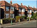
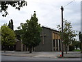
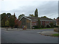
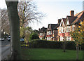
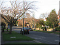
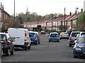
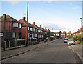
Photos of NG8 1BF

Area Information
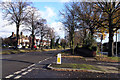
NG8 1BF is a specific postcode area covering a compact residential cluster within England. The site spans just 1756 square metres, which creates a tightly knit environment compared to larger suburban developments. This small footprint supports a population of 1938 people, resulting in a very high population density of 1413 people per square kilometre. Living in this postcode means you are part of a dense community where homes are relatively close together. The area functions as a distinct residential hub rather than a sprawling neighbourhood. You will find that space is at a premium, and the layout is designed for efficient use of land. This concentration of residents defines the character of daily life here, offering immediate proximity to neighbours while maintaining a focused residential identity. The physical boundaries of this area are crisp and well-defined, separating it from surrounding zones. Understanding these dimensions helps you grasp the scale of what it means to call NG8 1BF home.
- Area Type
- Postcode
- Area Size
- 1756 m²
- Population
- 1938
- Population Density
- 1413 people/km²
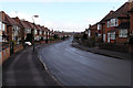
The property market in NG8 1BF is characterised by a strong presence of owner-occupiers rather than landlords. With home ownership standing at 76%, this area feels more like a traditional family neighbourhood than a rental hub. The dominance of houses as the main accommodation type further reinforces this picture of a buy-to-stay market. Property investors looking for a high volume of tenanted flats will find little opportunity here. Instead, the housing stock consists largely of single-family homes held by people who have lived in the area for years. This market structure benefits buyers seeking stability, as a high ownership rate often correlates with lower tenant turnover and more attentive maintenance. If you are considering purchasing homes in NG8 1BF or its immediate surroundings, expect a traditional brick-and-mortar transaction rather than a modern buy-to-let investment scenario. The small size of the postcode area limits the sheer number of transactions compared to larger districts, making each individual property sale more visible within the community.
House Prices in NG8 1BF
Showing 6 properties
| Address | Type | Beds | Baths | Last Sale Price | Last Sale Date | |
|---|---|---|---|---|---|---|
| 4 Heartwood Close, Nottingham, NG8 1BF | Semi-detached | 2 | 1 | £260,260 | Jan 2025 | |
| 6 Heartwood Close, Nottingham, NG8 1BF | house | - | - | £349,995 | Sep 2021 | |
| 1 Heartwood Close, Nottingham, NG8 1BF | Detached | 3 | 2 | - | - | |
| 3 Heartwood Close, Nottingham, NG8 1BF | Detached | 2 | 1 | - | - | |
| 2 Heartwood Close, Nottingham, NG8 1BF | Semi-detached | 2 | 1 | - | - | |
| 5 Heartwood Close, Nottingham, NG8 1BF | house | - | - | - | - |
Energy Efficiency in NG8 1BF
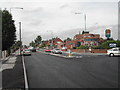
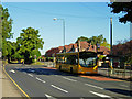
Residents of NG8 1BF enjoy convenient access to five retail outlets, five tram stops, and five railway stations within practical reach. You can shop at Co-op Wollaton, Lidl Beechdale, or Heron Bilborough for your groceries and essentials. The area is well connected via the tram network, specifically through Wilkinson Street Tram Stop, Queens Medical Centre Tram Stop, and Radford Road Tram Stop. Commuters also have five rail options, including Beeston Railway Station, Bulwell Railway Station, and Nottingham Railway Station, providing extensive links across the wider region. Nottingham Airport is accessible as a single nearby venue for business travel or private flights. This blend of retail and transport options creates a lifestyle where daily errands and regional commutes require minimal travel time. You do not need to travel far to find shops, public transit, or leisure facilities. All necessary amenities are clustered close to your doorstep, reducing the need for long journeys to the city centre or other suburbs.
Amenities
Schools
| Rank | School | Type | Entry gender | Ages |
|---|
Explore more schools in this area
Go to Schools tabDemographics
The community in NG8 1BF has a mature character defined by its residents' age profile. The median age for the population is 47 years, indicating a predominantly established group with significant life experience. Most commonly, you will find adults aged between 30 and 64 years occupying these homes. This demographic suggests a stable family environment or downsizers seeking convenience rather than first-time buyers looking to start their internet journey. Home ownership levels are exceptionally high at 76%, reflecting a neighbourhood where residents have built equity and settled long-term. Houses constitute the primary form of accommodation, meaning you will not find high-rise blocks or retirement flats dominating the skyline. The predominant ethnic group is White, which aligns with the broader demographic trends of the region. These figures point toward a quiet, established community where stability and ownership are the norm rather than the exception.
Household Size
Accommodation Type
Tenure
Ethnic Group
Religion
Household Composition
Age
Household Deprivation
NS-SEC
Explore more demographic insights in this area
Go to Demographics tabPlanning
Planning Constraints
- Flood RiskPremium
- Ramsar Wetland SitesPremium
- Area of Outstanding Natural BeautyPremium
- Protected Nature ReservePremium
- Protected WoodlandPremium