Area Overview for NG7 2RE
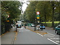
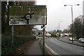
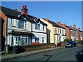
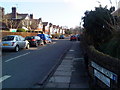
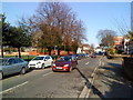
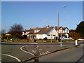
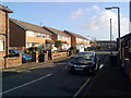
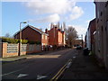
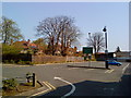
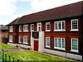
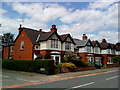
Photos of NG7 2RE

Area Information
Living in NG7 2RE offers a distinct experience within the Nottingham postcode framework, defined by high density and close proximity to city centre amenities. This specific cluster contains approximately 4950 residents, creating a compact neighbourhood where daily routines happen at a brisk pace. The population density reaches 3972 people per square kilometre, indicating a built-up environment rather than a sprawling suburb. You will find yourself in a setting where housing is packed efficiently, keeping distances between shops, transport links, and colleagues short. This tight-knit arrangement suits those who prioritise convenience and wish to maximise their use of time outside the home. The area functions as a residential hub bridging local estates with the wider city infrastructure. Daily life here revolves around easy access to the tram network and rail stations without needing a car for most trips. The concentration of 4950 people fosters a lively street scene, though the simplicity of the layout means fewer hidden corners to explore compared to larger districts. For a prospective buyer, NG7 2RE represents a practical choice where efficiency governs the design of the neighbourhood. You gain immediate access to major thoroughfares while remaining settled in a defined cluster. This location avoids the isolation found in remote suburbs while retaining the accessibility of the inner city fringe. It is a straightforward, functional address for those seeking a base close to employment and education hubs.
- Area Type
- Postcode
- Area Size
- Not available
- Population
- 4950
- Population Density
- 3972 people/km²
The housing stock in NG7 2RE is dominated by houses, yet the market dynamic is shaped by a low level of home ownership. Only 32 percentage of residents own their property, indicating a significant rental sector or a population in transitional housing phases. This disparity suggests the area serves as a launching pad for young people rather than a settlement for long-term established homeowners. Buyers should note that while the physical accommodation type is house-based, the tenure mix means competition for owned properties may be fiercer. The 32 percentage ownership rate highlights a fluid market where leases change hands regularly. For those seeking stability, NG7 2RE presents a specific opportunity despite the demographic skew. The prevalence of traditional house structures offers a different character than the flats common in dense city cores. You might encounter single-family homes or semi-detached properties that accommodate the younger demographic looking for independence. The low ownership figure of 32 percentage often drives lower property prices relative to similar-sized houses in older estate areas. Conversely, this fluidity means resale value can fluctuate based on broader housing trends affecting student populations. A buyer here must weigh the advantages of a house structure against the higher risk of renting in such a young-dominated zone. The market is fundamentally defined by this tension between traditional housing stock and a transient tenant base.
House Prices in NG7 2RE
Showing 1 properties
| Address | Type | Beds | Baths | Last Sale Price | Last Sale Date | |
|---|---|---|---|---|---|---|
| Ancaster Hall Main Building, University Of Nottingham, Beeston Lane, Nottingham, NG7 2RE | studentAccommodation | - | - | - | - |
Energy Efficiency in NG7 2RE
Daily life in NG7 2RE benefits from an immediate circle of retail, transport, and leisure amenities. Five major supermarkets operate nearby, including Co-op Nottingham, Spar, and Sainsburys Beeston. These retailers handle your weekly grocery shopping and household essentials without requiring a lengthy journey. The transport network anchors the lifestyle, with five metro stops including University Boulevard Tram Stop providing direct rails to the city. You also have access to five rail stations like Beeston Railway Station for wider travel. Nottingham Airport serves as the eighth-hour point for flight connections, though fewer services depart directly from this small facility. Five key tram interchange points facilitate movement through the wider region. The proximity of Sainsburys Beeston and Co-op Nottingham means you do not need to plan a specific trip to the city for food. You can restock pantries hours after returning from work thanks to these strategic locations. The presence of five rail stations ensures that work commutes do not consume excessive time. Whether prioritising fresh produce from Spar or national goods from Sainsburys Beeston, the retail density supports a self-sufficient lifestyle. The five metro stops and five rail stations integrate seamlessly with the shopping options. This layout allows you to navigate the area efficiently on foot or public transit.
Amenities
Schools
| Rank | School | Type | Entry gender | Ages |
|---|
Explore more schools in this area
Go to Schools tabDemographics
The community in NG7 2RE skews heavily towards youth, with a median age of just 22 years. Young adults aged between 15 and 29 years represent the most common age range within this postcode. This youthful skew suggests the area attracts students and young professionals rather than families with established households. You are looking at a demographic where energy and dynamism define the local atmosphere, likely reflecting the influence of nearby university facilities. Only 32 percentage of residents own their home, meaning the majority live in private rentals or are on the move frequently. Accommodation predominantly consists of houses, which stands out against the typical high-rise profile of some city centres. The predominant ethnic group is White, shaping the cultural character of the local interactions. This demographic split tells a clear story about who calls NG7 2RE home. The low homeownership rate of 32 percentage often correlates with cheaper entry-level housing or student accommodation block types, even if the primary structure is a house. The presence of so many young adults creates a demand for social spaces and affordable living arranged around specific amenities. You will find a group that values proximity to work and study sites over traditional community building projects. The 22-year median age ensures that noise levels and late-night activity remain high during term time.
Household Size
Accommodation Type
Tenure
Ethnic Group
Religion
Household Composition
Age
Household Deprivation
NS-SEC
Explore more demographic insights in this area
Go to Demographics tabPlanning
Planning Constraints
- Flood RiskPremium
- Ramsar Wetland SitesPremium
- Area of Outstanding Natural BeautyPremium
- Protected Nature ReservePremium
- Protected WoodlandPremium