Area Overview for NG7 2JP
Photos of NG7 2JP

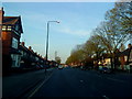
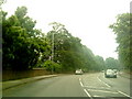
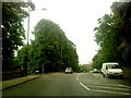
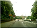
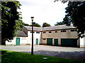
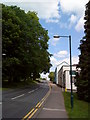

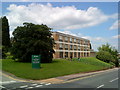
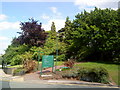
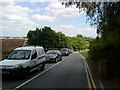
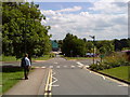
100 photos from this area
Area Information
Key information about the NG7 2JP including its size, population, and administrative classification.
- Area Type
- Postcode
- Area Size
- 1.2 hectares
- Population
- 2673
- Population Density
- 2192 people/km²
House Prices in NG7 2JP
31
Properties
£188,305
Average Sold Price
£80,000
Lowest Price
£425,000
Highest Price
Showing 31 properties
| Address | Type | Beds | Baths | Last Sale Price | Last Sale Date | |
|---|---|---|---|---|---|---|
| 102 Beeston Road, Nottingham, NG7 2JP | Detached | 6 | 3 | £425,000 | Mar 2025 | |
| 42 Beeston Road, Nottingham, NG7 2JP | house | - | - | £210,000 | Jan 2024 | |
| 78 Beeston Road, Nottingham, NG7 2JP | Semi-detached | 3 | 2 | £200,000 | Jan 2024 | |
| 68 Beeston Road, Nottingham, NG7 2JP | Retail | 2 | 1 | £190,000 | Sep 2022 | |
| 48 Beeston Road, Nottingham, NG7 2JP | Semi-detached | 6 | 3 | £390,000 | Mar 2021 | |
| 54 Beeston Road, Nottingham, NG7 2JP | Semi-detached | 3 | 1 | £210,000 | Dec 2020 | |
| 96 Beeston Road, Nottingham, NG7 2JP | Semi-detached | 5 | 2 | £205,000 | Nov 2019 | |
| 98 Beeston Road, Nottingham, NG7 2JP | Semi-detached | 6 | 4 | £205,000 | Nov 2019 | |
| 88 Beeston Road, Nottingham, NG7 2JP | Detached | 3 | 1 | £225,000 | Jun 2019 | |
| 70 Beeston Road, Nottingham, NG7 2JP | house | 4 | - | £240,000 | Nov 2018 |
Page 1 of 4
Energy Efficiency in NG7 2JP
Amenities
Schools
| Rank | School | Type | Entry gender | Ages |
|---|
Explore more schools in this area
Go to Schools tabDemographics
Household Size
Family (3-5 people)
most common
Accommodation Type
Houses
most common
Tenure
22
majority
Ethnic Group
White
most common
Religion
N/A
most common
Household Composition
N/A
most common
Age
22
median
Young Adults (15-29 years)
most common
Household Deprivation
N/A
with no deprivation
NS-SEC
12
in Lower managerial occupations
Explore more demographic insights in this area
Go to Demographics tabPlanning
Planning Constraints
- Flood RiskPremium
- Ramsar Wetland SitesPremium
- Area of Outstanding Natural BeautyPremium
- Protected Nature ReservePremium
- Protected WoodlandPremium