Area Overview for NG6 9FW
Photos of NG6 9FW
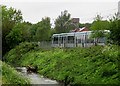
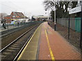
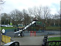
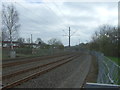
61 photos from this area
Area Information
Key information about the NG6 9FW including its size, population, and administrative classification.
- Area Type
- Postcode
- Area Size
- 8528 m²
- Population
- 1511
- Population Density
- 10073 people/km²
House Prices in NG6 9FW
55
Properties
£72,462
Average Sold Price
£23,500
Lowest Price
£163,500
Highest Price
Showing 55 properties
| Address | Type | Beds | Baths | Last Sale Price | Last Sale Date | |
|---|---|---|---|---|---|---|
| 74 Logan Street, Nottingham, NG6 9FW | Terraced | 2 | 1 | £146,500 | Apr 2024 | |
| 78 Logan Street, Nottingham, NG6 9FW | Terraced | 3 | 1 | £157,500 | Jan 2024 | |
| 108 Logan Street, Nottingham, NG6 9FW | Terraced | 3 | 1 | £163,500 | Jun 2023 | |
| 80 Logan Street, Nottingham, NG6 9FW | Terraced | 2 | 1 | £108,000 | Jul 2022 | |
| 144 Logan Street, Nottingham, NG6 9FW | Terraced | 3 | 1 | £137,500 | Feb 2021 | |
| 128 Logan Street, Nottingham, NG6 9FW | Terraced | 2 | 1 | £80,000 | Sep 2020 | |
| 58 Logan Street, Nottingham, NG6 9FW | Terraced | 2 | 1 | £110,000 | Jul 2020 | |
| 120 Logan Street, Nottingham, NG6 9FW | Terraced | 2 | 1 | £70,000 | May 2020 | |
| 82 Logan Street, Nottingham, NG6 9FW | Terraced | 2 | 1 | £108,000 | Feb 2020 | |
| 88 Logan Street, Nottingham, NG6 9FW | Terraced | 2 | 1 | £98,000 | Sep 2018 |
Page 1 of 6
Energy Efficiency in NG6 9FW
Amenities
Schools
| Rank | School | Type | Entry gender | Ages |
|---|
Explore more schools in this area
Go to Schools tabDemographics
Household Size
Two person
most common
Accommodation Type
Houses
most common
Tenure
70
majority
Ethnic Group
White
most common
Religion
N/A
most common
Household Composition
N/A
most common
Age
47
median
Adults (30-64 years)
most common
Household Deprivation
N/A
with no deprivation
NS-SEC
25
in Lower managerial occupations
Explore more demographic insights in this area
Go to Demographics tabPlanning
Planning Constraints
- Flood RiskPremium
- Ramsar Wetland SitesPremium
- Area of Outstanding Natural BeautyPremium
- Protected Nature ReservePremium
- Protected WoodlandPremium