Area Overview for NG6 0NH
Photos of NG6 0NH

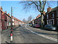
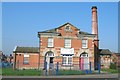
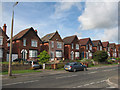
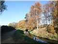
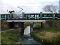
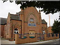
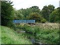
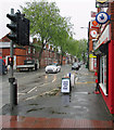
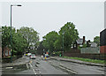
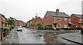
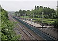
100 photos from this area
Area Information
Key information about the NG6 0NH including its size, population, and administrative classification.
- Area Type
- Postcode
- Area Size
- 5098 m²
- Population
- 1678
- Population Density
- 4369 people/km²
House Prices in NG6 0NH
17
Properties
£101,224
Average Sold Price
£57,500
Lowest Price
£189,000
Highest Price
Showing 17 properties
| Address | Type | Beds | Baths | Last Sale Price | Last Sale Date | |
|---|---|---|---|---|---|---|
| 2 Songthrush Avenue, Nottingham, NG6 0NH | Semi-detached | 2 | 1 | £189,000 | May 2023 | |
| 1 Songthrush Avenue, Nottingham, NG6 0NH | Terraced | 2 | 1 | £127,000 | Jul 2019 | |
| 3 Songthrush Avenue, Nottingham, NG6 0NH | Terraced | 2 | 1 | £112,000 | May 2019 | |
| 4 Songthrush Avenue, Nottingham, NG6 0NH | Semi-detached | 2 | - | £116,000 | Jul 2017 | |
| 18 Songthrush Avenue, Nottingham, NG6 0NH | Terraced | 2 | - | £105,000 | Jul 2015 | |
| 7 Songthrush Avenue, Nottingham, NG6 0NH | house | 3 | - | £112,500 | Oct 2010 | |
| 16 Songthrush Avenue, Nottingham, NG6 0NH | Terraced | - | - | £109,950 | Jan 2007 | |
| 15 Songthrush Avenue, Nottingham, NG6 0NH | Terraced | - | - | £125,000 | Feb 2006 | |
| 12 Songthrush Avenue, Nottingham, NG6 0NH | house | - | - | £130,000 | Nov 2005 | |
| 10 Songthrush Avenue, Nottingham, NG6 0NH | house | - | - | £84,000 | Feb 2004 |
Page 1 of 2
Energy Efficiency in NG6 0NH
Amenities
Schools
| Rank | School | Type | Entry gender | Ages |
|---|
Explore more schools in this area
Go to Schools tabDemographics
Household Size
One person
most common
Accommodation Type
Houses
most common
Tenure
46
majority
Ethnic Group
White
most common
Religion
N/A
most common
Household Composition
N/A
most common
Age
47
median
Adults (30-64 years)
most common
Household Deprivation
N/A
with no deprivation
NS-SEC
28
in Lower managerial occupations
Explore more demographic insights in this area
Go to Demographics tabPlanning
Planning Constraints
- Flood RiskPremium
- Ramsar Wetland SitesPremium
- Area of Outstanding Natural BeautyPremium
- Protected Nature ReservePremium
- Protected WoodlandPremium