Area Overview for NG6 0EP
Photos of NG6 0EP
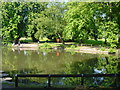
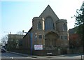
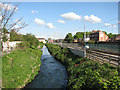
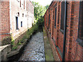

100 photos from this area
Area Information
Key information about the NG6 0EP including its size, population, and administrative classification.
- Area Type
- Postcode
- Area Size
- 1.2 hectares
- Population
- 1999
- Population Density
- 5660 people/km²
House Prices in NG6 0EP
71
Properties
£92,768
Average Sold Price
£18,500
Lowest Price
£180,000
Highest Price
Showing 71 properties
| Address | Type | Beds | Baths | Last Sale Price | Last Sale Date | |
|---|---|---|---|---|---|---|
| 66 Wallis Street, Nottingham, NG6 0EP | house | - | - | £150,000 | Sep 2025 | |
| 24 Wallis Street, Nottingham, NG6 0EP | Terraced | 2 | 1 | £150,000 | Feb 2025 | |
| 60 Wallis Street, Nottingham, NG6 0EP | Terraced | 3 | 1 | £160,000 | Dec 2024 | |
| 51 Wallis Street, Nottingham, NG6 0EP | Terraced | 2 | 1 | £168,000 | Jan 2024 | |
| 47 Wallis Street, Nottingham, NG6 0EP | Terraced | 2 | 1 | £180,000 | Nov 2022 | |
| 79 Wallis Street, Nottingham, NG6 0EP | Retail | 3 | 1 | £167,500 | Aug 2022 | |
| 42 Wallis Street, Nottingham, NG6 0EP | Terraced | 3 | 3 | £155,100 | Apr 2022 | |
| 53 Wallis Street, Nottingham, NG6 0EP | Terraced | 3 | 1 | £134,150 | Apr 2022 | |
| 20 Wallis Street, Nottingham, NG6 0EP | Terraced | 2 | 1 | £125,000 | Oct 2021 | |
| 45 Wallis Street, Nottingham, NG6 0EP | Terraced | 3 | 1 | £121,000 | May 2021 |
Page 1 of 8
Energy Efficiency in NG6 0EP
Amenities
Schools
| Rank | School | Type | Entry gender | Ages |
|---|
Explore more schools in this area
Go to Schools tabDemographics
Household Size
One person
most common
Accommodation Type
Houses
most common
Tenure
39
majority
Ethnic Group
White
most common
Religion
N/A
most common
Household Composition
N/A
most common
Age
47
median
Adults (30-64 years)
most common
Household Deprivation
N/A
with no deprivation
NS-SEC
22
in Lower managerial occupations
Explore more demographic insights in this area
Go to Demographics tabPlanning
Planning Constraints
- Flood RiskPremium
- Ramsar Wetland SitesPremium
- Area of Outstanding Natural BeautyPremium
- Protected Nature ReservePremium
- Protected WoodlandPremium