Area Overview for NG5 8TE
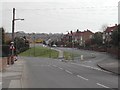
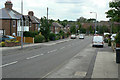
Photos of NG5 8TE


Area Information
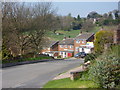
Living in NG5 8TE offers a quiet residential experience within a small, defined cluster. The population here stands at 1,397 people, creating a neighbourhood with a distinct intimate scale while remaining accessible to wider infrastructure. You will find this postcode is situated in England, surrounded by the practical conveniences of larger towns without the associated noise or congestion. Daily life revolves around a stable environment where community ties likely run deeper due to the concentrated nature of the housing. Residents enjoy proximity to major transport links, including tram stops and railway stations, which connect them to employment centres in the city. The area avoids significant planning constraints, meaning there are no designated nature reserves or protected woodlands to restrict local development or alter the character of the street. This stability makes the location straightforward for those seeking a settled home. You can move here knowing the landscape is free from flood risks or Ramsar wetland restrictions that might complicate future building projects. The setting prioritises practical living over environmental designations, focusing instead on immediate access to shops and transport. For a family or individual looking for a low-maintenance, safe, and owner-led environment, this cluster provides a solid foundation.
- Area Type
- Postcode
- Area Size
- Not available
- Population
- 1397
- Population Density
- 6035 people/km²
The property market in NG5 8TE is defined by a strong preference for ownership and traditional housing stock. With 85% of residents being homeowners, the area functions primarily as an owner-occupied locality rather than a rental market. This high ownership rate means you will encounter few tenants and many long-term neighbours. The accommodation type is consistently listed as houses, confirming that apartments or commercial units are not a feature of this postcode. This specificity is crucial for buyers who wish to purchase a standard family home rather than a flat. The resident count of 1,397 suggests a limited inventory of available properties, so keen buyers should act promptly if they wish to purchase homes in NG5 8TE or the immediate cluster. The absence of rental pressure from a large transient population helps maintain stability in the area. Planning constraints do not currently encroach on the land, with no areas of outstanding natural beauty or protected nature reserves limiting construction. However, the total population size indicates that new large-scale developments are unlikely. You are looking at a mature housing stock where the demand for family-sized properties is met by the existing supply of houses. This makes the market suitable for those seeking a conventional British suburban home without the complexities of leasehold flats or shared ownership schemes.
House Prices in NG5 8TE
No properties found in this postcode.
Energy Efficiency in NG5 8TE
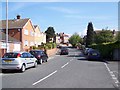
Your daily life in NG5 8TE is supported by a convenient array of amenities within practical reach. Retail options are straightforward, with five shops available nearby, including a Spar and a Co-op Coppice, as well as the larger Asda Arnold. You can easily handle bulk shopping and essentials without travelling far into the city centre. Transport accessibility is a major lifestyle feature, with five metro stops and five rail stations in the vicinity. The Moor Bridge, Bulwell Forest, and David Lane tram stops allow for rapid city access. Meanwhile, Bulwell, Carlton, and Hucknall railway stations open up opportunities for national travel. This density of transport and retail hubs means you do not need a car for short trips. The area avoids complex planning constraints like protected woodlands or nature reserves, resulting in open space usage that aligns with residential needs. You will not find manicured green belts on your doorstep, but the proximity to Bulwell and Arnold suggests access to larger parks and leisure facilities in surrounding towns. The lifestyle here is utilitarian and efficient, prioritising speed and access over exclusive, gated-community exclusivity. You live in a zone where daily errands and commutes are time-efficient.
Amenities
Schools
Families moving to NG5 8TE have access to specific educational facilities nearby. The primary option listed for this area is Richard Bonington Primary and Nursery School. This institution serves as the dedicated primary education provider for young children in the cluster. The data identifies this school twice, which may indicate its significance as the main educational hub for the immediate zone or a dual-entry in the record. There are no secondary schools or independent colleges explicitly named in the available data for NG5 8TE, meaning older children will likely need to travel to other towns for further education. The presence of a single named primary school suggests a focused provision for early childhood and primary years. You do not have a choice of multiple primary options within the immediate postcode, unlike larger urban districts. The school type is confirmed as primary, catering to pupils before they transition to secondary education. For parents locating schools near NG5 8TE, this specific name is the key reference point. The data does not provide Ofsted ratings, so you should verify the current inspection scores directly with the school administration. This single-named provision creates a clear, albeit limited, educational boundary for residents looking to keep their children in the local catchment.
| Rank | School | Type | Entry gender | Ages |
|---|
Explore more schools in this area
Go to Schools tabDemographics
The community in NG5 8TE reflects a mature, settled demographic profile. The median age is 47 years, indicating a population dominated by adults between 30 and 64 years old. This age range suggests the area attracts older families, established professionals, and those seeking stability rather than a high-energy student crowd. Home ownership is exceptionally high at 85%, which signals a long-term commitment to the location by current residents. This statistic reinforces the nature of the neighbourhood as a place for people to put down roots rather than a transient rental hub. The predominant ethnic group is White, contributing to a homogeneous cultural atmosphere. Accommodation types are exclusively houses, meaning the streetscape is characterised by detached or semi-detached family homes rather than apartments or flats. You will not find high-density living here. The combination of a high median age, strong home ownership rates, and single-family housing creates a quiet, residential environment. The lack of young adult renters or student populations means less late-night activity at street level. Safety scores align with this profile, showing a risk level of 80 out of 100, which categorises the area as having low crime risk and below-average crime rates. These factors combine to offer a predictable and secure setting for permanent residents.
Household Size
Accommodation Type
Tenure
Ethnic Group
Religion
Household Composition
Age
Household Deprivation
NS-SEC
Explore more demographic insights in this area
Go to Demographics tabPlanning
Planning Constraints
- Flood RiskPremium
- Ramsar Wetland SitesPremium
- Area of Outstanding Natural BeautyPremium
- Protected Nature ReservePremium
- Protected WoodlandPremium