Area Overview for NG5 8RD
Photos of NG5 8RD
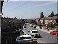
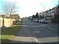
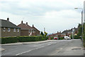
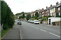
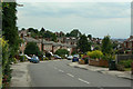
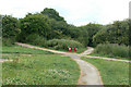
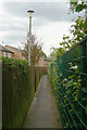
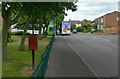
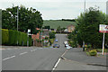
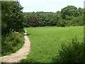
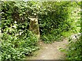
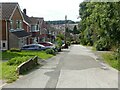
34 photos from this area
Area Information
Key information about the NG5 8RD including its size, population, and administrative classification.
- Area Type
- Postcode
- Area Size
- 1.0 hectares
- Population
- 1450
- Population Density
- 4006 people/km²
House Prices in NG5 8RD
26
Properties
£151,324
Average Sold Price
£55,000
Lowest Price
£230,000
Highest Price
Showing 26 properties
| Address | Type | Beds | Baths | Last Sale Price | Last Sale Date | |
|---|---|---|---|---|---|---|
| 126 Killisick Road, Arnold, NG5 8RD | Terraced | 2 | 1 | £175,000 | Jun 2025 | |
| 130 Killisick Road, Arnold, NG5 8RD | house | 2 | 1 | £168,000 | Sep 2021 | |
| 116 Killisick Road, Arnold, NG5 8RD | Semi-detached | 2 | 1 | £158,000 | Aug 2020 | |
| 122 Killisick Road, Arnold, NG5 8RD | Semi-detached | 2 | 1 | £167,500 | Jun 2020 | |
| 132 Killisick Road, Arnold, NG5 8RD | Semi-detached | 2 | 1 | £135,000 | Jun 2020 | |
| 66 Killisick Road, Arnold, NG5 8RD | Semi-detached | 3 | 1 | £152,000 | Apr 2019 | |
| 120 Killisick Road, Arnold, NG5 8RD | Detached | 2 | 1 | £155,000 | Feb 2019 | |
| 114 Killisick Road, Arnold, NG5 8RD | house | - | - | £126,000 | Jun 2017 | |
| 134 Killisick Road, Arnold, NG5 8RD | Semi-detached | 4 | 2 | £230,000 | Jun 2017 | |
| 56 Killisick Road, Arnold, NG5 8RD | Detached | 4 | 2 | £230,000 | Oct 2014 |
Page 1 of 3
Energy Efficiency in NG5 8RD
Amenities
Schools
| Rank | School | Type | Entry gender | Ages |
|---|
Explore more schools in this area
Go to Schools tabDemographics
Household Size
Two person
most common
Accommodation Type
Houses
most common
Tenure
74
majority
Ethnic Group
White
most common
Religion
N/A
most common
Household Composition
N/A
most common
Age
47
median
Adults (30-64 years)
most common
Household Deprivation
N/A
with no deprivation
NS-SEC
41
in Lower managerial occupations
Explore more demographic insights in this area
Go to Demographics tabPlanning
Planning Constraints
- Flood RiskPremium
- Ramsar Wetland SitesPremium
- Area of Outstanding Natural BeautyPremium
- Protected Nature ReservePremium
- Protected WoodlandPremium