Area Overview for NG5 8PH
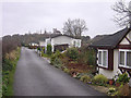
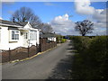
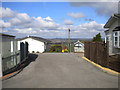
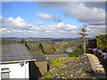
Photos of NG5 8PH
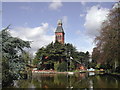
![Bestwood Pumping Station [1] in NG5 8PH](https://images.propbar.co.uk/images/geograph/53/50/5350843_120.jpg)
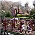
![Bestwood Pumping Station [2] in NG5 8PH](https://images.propbar.co.uk/images/geograph/53/51/5351898_120.jpg)
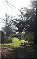
![Bestwood Pumping Station [5] in NG5 8PH](https://images.propbar.co.uk/images/geograph/53/51/5351929_120.jpg)
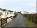
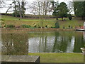
24 photos from this area
Area Information
Key information about the NG5 8PH including its size, population, and administrative classification.
- Area Type
- Postcode
- Area Size
- 1.0 km²
- Population
- 2253
- Population Density
- 243 people/km²
House Prices in NG5 8PH
11
Properties
£235,000
Average Sold Price
£235,000
Lowest Price
£235,000
Highest Price
Showing 11 properties
| Address | Type | Beds | Baths | Last Sale Price | Last Sale Date | |
|---|---|---|---|---|---|---|
| East Lodge At Bestwood Pumping Station, Mansfield Road, Bestwood, NG5 8PH | Detached | 2 | 1 | £235,000 | Nov 2019 | |
| Bottom House Farm, Mansfield Road, Bestwood, NG5 8PH | Detached | 2 | 1 | - | - | |
| Buckleap House, Mansfield Road, Bestwood, NG5 8PH | undefined | - | - | - | - | |
| Barn At, Bottom House Farm, Mansfield Road, Bestwood, NG5 8PH | Detached | - | - | - | - | |
| Orchy Lodge, Bottom House Farm, Mansfield Road, Bestwood, NG5 8PH | Bungalow | - | - | - | - | |
| Warehouse, Forest Farm, Mansfield Road, Arnold, NG5 8PH | warehouse | - | - | - | - | |
| The Willows Tophouse Farm, Mansfield Road, Bestwood, NG5 8PH | hotel | - | - | - | - | |
| Forest Farm, Mansfield Road, Arnold, NG5 8PH | Detached | - | - | - | - | |
| Lakeside, Mansfield Road, Bestwood, NG5 8PH | Retail | - | - | - | - | |
| Tophouse Farm, Mansfield Road, Bestwood, NG5 8PH | Detached | 5 | 2 | - | - |
Page 1 of 2
Energy Efficiency in NG5 8PH
Amenities
Schools
| Rank | School | Type | Entry gender | Ages |
|---|
Explore more schools in this area
Go to Schools tabDemographics
Household Size
Two person
most common
Accommodation Type
Houses
most common
Tenure
77
majority
Ethnic Group
White
most common
Religion
N/A
most common
Household Composition
N/A
most common
Age
47
median
Adults (30-64 years)
most common
Household Deprivation
N/A
with no deprivation
NS-SEC
32
in Lower managerial occupations
Explore more demographic insights in this area
Go to Demographics tabPlanning
Planning Constraints
- Flood RiskPremium
- Ramsar Wetland SitesPremium
- Area of Outstanding Natural BeautyPremium
- Protected Nature ReservePremium
- Protected WoodlandPremium