Area Overview for NG5 8FQ
Photos of NG5 8FQ
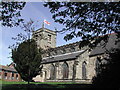
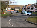
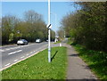
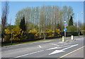
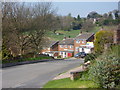
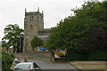
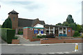
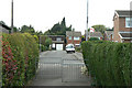
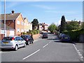
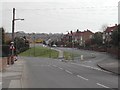
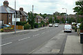
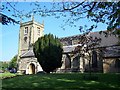
61 photos from this area
Area Information
Key information about the NG5 8FQ including its size, population, and administrative classification.
- Area Type
- Postcode
- Area Size
- 1.8 hectares
- Population
- 1397
- Population Density
- 6035 people/km²
House Prices in NG5 8FQ
16
Properties
£198,278
Average Sold Price
£38,000
Lowest Price
£517,000
Highest Price
Showing 16 properties
| Address | Type | Beds | Baths | Last Sale Price | Last Sale Date | |
|---|---|---|---|---|---|---|
| 87 Calverton Road, Arnold, NG5 8FQ | Semi-detached | 2 | 1 | £160,000 | May 2023 | |
| 99 Calverton Road, Arnold, NG5 8FQ | Retail | 3 | 1 | £195,000 | Aug 2022 | |
| 93 Calverton Road, Arnold, NG5 8FQ | house | - | - | £517,000 | Aug 2021 | |
| 95 Calverton Road, Arnold, NG5 8FQ | Bungalow | 3 | 1 | £270,000 | Jan 2020 | |
| 103 Calverton Road, Arnold, NG5 8FQ | Semi-detached | 3 | 1 | £157,000 | Aug 2016 | |
| 101 Calverton Road, Arnold, NG5 8FQ | Semi-detached | 3 | 1 | £150,000 | Aug 2016 | |
| 105 Calverton Road, Arnold, NG5 8FQ | Detached | 2 | - | £135,000 | Feb 2016 | |
| 85 Calverton Road, Arnold, NG5 8FQ | house | 3 | - | £162,500 | Dec 2011 | |
| 87A Calverton Road, Arnold, NG5 8FQ | Semi-detached | - | - | £38,000 | Nov 1996 | |
| Ancillary Dwelling, 93 Calverton Road, Arnold, NG5 8FQ | Detached | - | - | - | - |
Page 1 of 2
Energy Efficiency in NG5 8FQ
Amenities
Schools
| Rank | School | Type | Entry gender | Ages |
|---|
Explore more schools in this area
Go to Schools tabDemographics
Household Size
Two person
most common
Accommodation Type
Houses
most common
Tenure
85
majority
Ethnic Group
White
most common
Religion
N/A
most common
Household Composition
N/A
most common
Age
47
median
Adults (30-64 years)
most common
Household Deprivation
N/A
with no deprivation
NS-SEC
31
in Lower managerial occupations
Explore more demographic insights in this area
Go to Demographics tabPlanning
Planning Constraints
- Flood RiskPremium
- Ramsar Wetland SitesPremium
- Area of Outstanding Natural BeautyPremium
- Protected Nature ReservePremium
- Protected WoodlandPremium