Area Overview for NG5 7JP
Photos of NG5 7JP
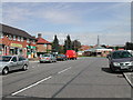
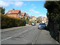
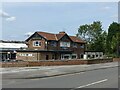
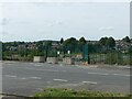
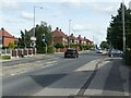
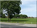
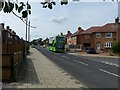
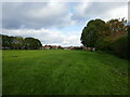

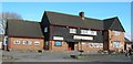
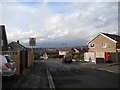
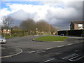
23 photos from this area
Area Information
Key information about the NG5 7JP including its size, population, and administrative classification.
- Area Type
- Postcode
- Area Size
- 1.7 hectares
- Population
- 1658
- Population Density
- 5148 people/km²
House Prices in NG5 7JP
14
Properties
£188,286
Average Sold Price
£140,000
Lowest Price
£250,000
Highest Price
Showing 14 properties
| Address | Type | Beds | Baths | Last Sale Price | Last Sale Date | |
|---|---|---|---|---|---|---|
| 126 Rolleston Drive, Arnold, NG5 7JP | Semi-detached | 3 | 1 | £220,000 | Jul 2025 | |
| 122 Rolleston Drive, Arnold, NG5 7JP | Semi-detached | 3 | 1 | £225,000 | Nov 2022 | |
| 128 Rolleston Drive, Arnold, NG5 7JP | Detached | 3 | 1 | £250,000 | Jun 2021 | |
| 120 Rolleston Drive, Arnold, NG5 7JP | Semi-detached | 3 | 1 | £171,000 | Dec 2019 | |
| 124 Rolleston Drive, Arnold, NG5 7JP | Semi-detached | 3 | 1 | £170,000 | Apr 2019 | |
| 116 Rolleston Drive, Arnold, NG5 7JP | Semi-detached | 3 | 1 | £140,000 | Aug 2015 | |
| 118 Rolleston Drive, Arnold, NG5 7JP | house | - | - | £142,000 | Jul 2015 | |
| First Floor Middle Right, Byidon House, 92 Rolleston Drive, Arnold, NG5 7JP | Office | - | - | - | - | |
| Ground Floor Front Right, Byidon House, 92 Rolleston Drive, Arnold, NG5 7JP | Office | - | - | - | - | |
| First Floor Rear Left, Byidon House, 92 Rolleston Drive, Arnold, NG5 7JP | Office | - | - | - | - |
Page 1 of 2
Energy Efficiency in NG5 7JP
Amenities
Schools
| Rank | School | Type | Entry gender | Ages |
|---|
Explore more schools in this area
Go to Schools tabDemographics
Household Size
Family (3-5 people)
most common
Accommodation Type
Houses
most common
Tenure
64
majority
Ethnic Group
White
most common
Religion
N/A
most common
Household Composition
N/A
most common
Age
47
median
Adults (30-64 years)
most common
Household Deprivation
N/A
with no deprivation
NS-SEC
25
in Lower managerial occupations
Explore more demographic insights in this area
Go to Demographics tabPlanning
Planning Constraints
- Flood RiskPremium
- Ramsar Wetland SitesPremium
- Area of Outstanding Natural BeautyPremium
- Protected Nature ReservePremium
- Protected WoodlandPremium