Area Overview for NG5 7JE
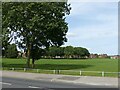
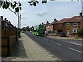
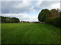
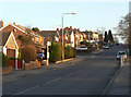
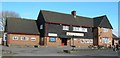
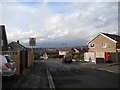
Photos of NG5 7JE


Area Information
NG5 7JE represents a small residential cluster in England, offering a contained living environment for 1,658 residents. This specific postcode area provides a defined space where daily life revolves around established neighbourhood boundaries rather than sprawling urban expansion. The locality functions as a quiet enclave, distinct from the broader metropolitan zones nearby. Those considering living in NG5 7JE will find a setting that prioritises residential stability over high-density urban textures. The area serves as a practical base for households seeking a specific postal address with clear property definitions. Your day-to-day experience here will centre on the immediate surroundings and the established rhythm of the few hundred homes contained within this specific code. It is a location where the community size allows for recognisable streets and a manageable scale of local interaction.
- Area Type
- Postcode
- Area Size
- Not available
- Population
- 1658
- Population Density
- 5148 people/km²
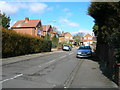
Homes in NG5 7JE are characterised by a strong prevalence of house ownership. Sixty-four percent of the population owns their accommodation, suggesting a market defined by long-term residents rather than high tenant turnover. The accommodation type is predominantly houses, which suits families seeking single-family spaces away from flat complexes. This data indicates that if you are looking to purchase a home here, you are likely examining a stock of detached or semi-detached properties designed for family living. The high ownership rate implies that previous buyers have settled in for the duration, often passing properties down or holding them for many years. When viewing properties in this postcode, expect a traditional housing stock rather than student rentals or temporary lettings. The market behaviour reflects stability, with fewer weekly transactions compared to rental-heavy zones.
House Prices in NG5 7JE
No properties found in this postcode.
Energy Efficiency in NG5 7JE
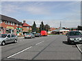
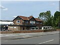
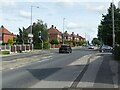
Residents of NG5 7JE have immediate access to a range of retail and mobility options within practical reach. Five retail outlets serve the local shopping needs, including Co-op Coppice, Spar, and Tesco Arnold. These specific venues provide groceries and daily essentials without requiring a long journey. Transport links are equally developed with five metro and five rail stations nearby, including Basford Tram Stop, David Lane Tram Stop, and Moor Bridge Tram Stop. Carlton Railway Station, Netherfield Railway Station, and Bulwell Railway Station further extend your travel radius to the wider network. Nottingham Airport stands as a single aviation link for longer-distance travel. This combination of shops and five named transport stops ensures you can travel to the city centre or regional towns with ease. Daily errands are resolved locally, while weekly trips utilize the tram or rail infrastructure effectively.
Amenities
Schools
Families residing in NG5 7JE benefit from access to two primary educational facilities nearby. Robert Mellors Primary and Nursery School offers early education options, while Robert Mellors Primary Academy provides primary schooling with a Ofsted rating of good. Both institutions carry the Robert Mellors name, suggesting a consistent educational heritage within the local catchment area. The presence of a primary academy indicates adherence to the national curriculum standards monitored by Ofsted. For residents prioritising education, the fact that one school holds a good rating provides a reassuring baseline for academic quality. This mix of nursery and primary provision supports children from three onwards. Parents looking for schools near NG5 7JE will find these named institutions as the primary choices within the immediate vicinity.
| Rank | School | Type | Entry gender | Ages |
|---|
Explore more schools in this area
Go to Schools tabDemographics
The community within NG5 7JE reflects the profiles typical of settled families and established residents. Adults between the ages of 30 and 64 years form the most common age range, indicating a demographic focused on household stability. The median age stands at 47 years, reinforcing the presence of long-term occupants rather than transient populations. Home ownership is significant, with 64% of residents owning their properties outright or via mortgage. The majority of homes in this area are houses, catering to families who require single-family residences over flats or apartments. The predominant ethnic group is White, aligning with the broader demographic trends of many English residential suburbs. This established age profile suggests a quiet atmosphere where neighbours typically know one another well, fostering a sense of local familiarity without the demographic shifts found in newer developments.
Household Size
Accommodation Type
Tenure
Ethnic Group
Religion
Household Composition
Age
Household Deprivation
NS-SEC
Explore more demographic insights in this area
Go to Demographics tabPlanning
Planning Constraints
- Flood RiskPremium
- Ramsar Wetland SitesPremium
- Area of Outstanding Natural BeautyPremium
- Protected Nature ReservePremium
- Protected WoodlandPremium