Area Overview for NG5 6QD
Photos of NG5 6QD
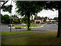
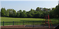
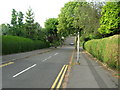
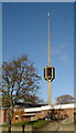
52 photos from this area
Area Information
Key information about the NG5 6QD including its size, population, and administrative classification.
- Area Type
- Postcode
- Area Size
- 2.4 hectares
- Population
- 1564
- Population Density
- 4978 people/km²
House Prices in NG5 6QD
52
Properties
£201,990
Average Sold Price
£45,500
Lowest Price
£520,000
Highest Price
Showing 52 properties
| Address | Type | Beds | Baths | Last Sale Price | Last Sale Date | |
|---|---|---|---|---|---|---|
| 31 Greendale Road, Arnold, NG5 6QD | Detached | 4 | 1 | £410,000 | Mar 2025 | |
| 14 Greendale Road, Arnold, NG5 6QD | Detached | 5 | 1 | £390,000 | Feb 2024 | |
| 33 Greendale Road, Arnold, NG5 6QD | Detached | 5 | 1 | £358,000 | Sep 2023 | |
| 39 Greendale Road, Arnold, NG5 6QD | Detached | 3 | 1 | £300,000 | Jul 2023 | |
| 46 Greendale Road, Arnold, NG5 6QD | house | 5 | 1 | £220,000 | Jun 2023 | |
| 7 Greendale Road, Arnold, NG5 6QD | Detached | 4 | 2 | £410,000 | Mar 2023 | |
| 25 Greendale Road, Arnold, NG5 6QD | Detached | 4 | 1 | £330,000 | Mar 2022 | |
| 48 Greendale Road, Arnold, NG5 6QD | Terraced | 2 | 2 | £188,000 | Mar 2022 | |
| 12 Greendale Road, Arnold, NG5 6QD | Detached | 4 | 2 | £520,000 | Feb 2022 | |
| 17 Greendale Road, Arnold, NG5 6QD | Detached | - | - | £237,500 | Sep 2021 |
Page 1 of 6
Energy Efficiency in NG5 6QD
Amenities
Schools
| Rank | School | Type | Entry gender | Ages |
|---|
Explore more schools in this area
Go to Schools tabDemographics
Household Size
One person
most common
Accommodation Type
Houses
most common
Tenure
73
majority
Ethnic Group
White
most common
Religion
N/A
most common
Household Composition
N/A
most common
Age
47
median
Adults (30-64 years)
most common
Household Deprivation
N/A
with no deprivation
NS-SEC
40
in Lower managerial occupations
Explore more demographic insights in this area
Go to Demographics tabPlanning
Planning Constraints
- Flood RiskPremium
- Ramsar Wetland SitesPremium
- Area of Outstanding Natural BeautyPremium
- Protected Nature ReservePremium
- Protected WoodlandPremium