Area Overview for NG5 6GB
Photos of NG5 6GB
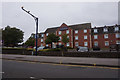
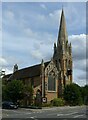
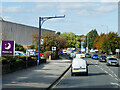
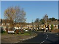
35 photos from this area
Area Information
Key information about the NG5 6GB including its size, population, and administrative classification.
- Area Type
- Postcode
- Area Size
- 1.4 hectares
- Population
- 1763
- Population Density
- 5057 people/km²
House Prices in NG5 6GB
41
Properties
£107,526
Average Sold Price
£37,500
Lowest Price
£198,000
Highest Price
Showing 41 properties
| Address | Type | Beds | Baths | Last Sale Price | Last Sale Date | |
|---|---|---|---|---|---|---|
| 41 Roundwood Road, Arnold, NG5 6GB | Semi-detached | 3 | 1 | £146,000 | Aug 2025 | |
| 30 Roundwood Road, Arnold, NG5 6GB | Detached | 3 | 1 | £155,000 | Jan 2025 | |
| 46 Roundwood Road, Arnold, NG5 6GB | Semi-detached | 3 | 1 | £198,000 | Feb 2023 | |
| 69 Roundwood Road, Arnold, NG5 6GB | Semi-detached | 3 | 1 | £145,000 | Jan 2020 | |
| 49 Roundwood Road, Arnold, NG5 6GB | Semi-detached | 3 | 2 | £152,500 | Sep 2018 | |
| 63 Roundwood Road, Arnold, NG5 6GB | Semi-detached | 4 | - | £125,000 | Aug 2013 | |
| 73 Roundwood Road, Arnold, NG5 6GB | house | 3 | - | £105,000 | Nov 2010 | |
| 50 Roundwood Road, Arnold, NG5 6GB | Semi-detached | - | - | £98,000 | Aug 2009 | |
| 53 Roundwood Road, Arnold, NG5 6GB | Semi-detached | - | - | £105,000 | Sep 2006 | |
| 44 Roundwood Road, Arnold, NG5 6GB | house | - | - | £117,000 | Apr 2006 |
Page 1 of 5
Energy Efficiency in NG5 6GB
Amenities
Schools
| Rank | School | Type | Entry gender | Ages |
|---|
Explore more schools in this area
Go to Schools tabDemographics
Household Size
Family (3-5 people)
most common
Accommodation Type
Houses
most common
Tenure
60
majority
Ethnic Group
White
most common
Religion
N/A
most common
Household Composition
N/A
most common
Age
47
median
Adults (30-64 years)
most common
Household Deprivation
N/A
with no deprivation
NS-SEC
23
in Lower managerial occupations
Explore more demographic insights in this area
Go to Demographics tabPlanning
Planning Constraints
- Flood RiskPremium
- Ramsar Wetland SitesPremium
- Area of Outstanding Natural BeautyPremium
- Protected Nature ReservePremium
- Protected WoodlandPremium