Area Overview for NG5 6EP
Photos of NG5 6EP
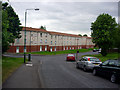
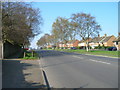
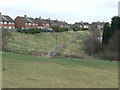
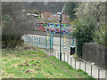
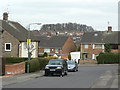
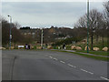
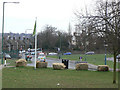
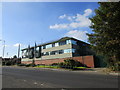
78 photos from this area
Area Information
Key information about the NG5 6EP including its size, population, and administrative classification.
- Area Type
- Postcode
- Area Size
- 8896 m²
- Population
- 1821
- Population Density
- 4464 people/km²
House Prices in NG5 6EP
27
Properties
£138,614
Average Sold Price
£27,000
Lowest Price
£280,000
Highest Price
Showing 27 properties
| Address | Type | Beds | Baths | Last Sale Price | Last Sale Date | |
|---|---|---|---|---|---|---|
| 214 Edwards Lane, Nottingham, NG5 6EP | Semi-detached | 4 | 2 | £245,000 | Oct 2025 | |
| 218 Edwards Lane, Nottingham, NG5 6EP | Detached | 3 | 1 | £180,000 | Jul 2025 | |
| 236 Edwards Lane, Nottingham, NG5 6EP | Semi-detached | 3 | 1 | £215,000 | Jun 2024 | |
| 252 Edwards Lane, Nottingham, NG5 6EP | Terraced | 2 | 1 | £140,000 | May 2023 | |
| 208 Edwards Lane, Nottingham, NG5 6EP | Detached | 4 | 2 | £280,000 | Apr 2023 | |
| 240 Edwards Lane, Nottingham, NG5 6EP | Terraced | 2 | 1 | £122,500 | Jan 2021 | |
| 224 Edwards Lane, Nottingham, NG5 6EP | house | 3 | - | £125,000 | Mar 2019 | |
| 234 Edwards Lane, Nottingham, NG5 6EP | house | - | - | £114,600 | Sep 2018 | |
| 250 Edwards Lane, Nottingham, NG5 6EP | house | - | - | £133,000 | Dec 2017 | |
| 216 Edwards Lane, Nottingham, NG5 6EP | Semi-detached | 3 | 1 | £138,500 | Jan 2016 |
Page 1 of 3
Energy Efficiency in NG5 6EP
Amenities
Schools
| Rank | School | Type | Entry gender | Ages |
|---|
Explore more schools in this area
Go to Schools tabDemographics
Household Size
Family (3-5 people)
most common
Accommodation Type
Houses
most common
Tenure
71
majority
Ethnic Group
White
most common
Religion
N/A
most common
Household Composition
N/A
most common
Age
47
median
Adults (30-64 years)
most common
Household Deprivation
N/A
with no deprivation
NS-SEC
41
in Lower managerial occupations
Explore more demographic insights in this area
Go to Demographics tabPlanning
Planning Constraints
- Flood RiskPremium
- Ramsar Wetland SitesPremium
- Area of Outstanding Natural BeautyPremium
- Protected Nature ReservePremium
- Protected WoodlandPremium