Area Overview for NG5 5RF
Photos of NG5 5RF
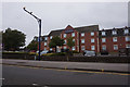
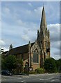
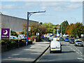
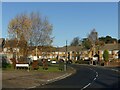
35 photos from this area
Area Information
Key information about the NG5 5RF including its size, population, and administrative classification.
- Area Type
- Postcode
- Area Size
- 1.3 hectares
- Population
- 1504
- Population Density
- 5013 people/km²
House Prices in NG5 5RF
22
Properties
£116,429
Average Sold Price
£29,000
Lowest Price
£185,000
Highest Price
Showing 22 properties
| Address | Type | Beds | Baths | Last Sale Price | Last Sale Date | |
|---|---|---|---|---|---|---|
| 88 Queens Bower Road, Nottingham, NG5 5RF | Semi-detached | 3 | 1 | £185,000 | Jul 2023 | |
| 76 Queens Bower Road, Nottingham, NG5 5RF | house | - | - | £168,000 | May 2021 | |
| 86 Queens Bower Road, Nottingham, NG5 5RF | house | 3 | - | £96,000 | Dec 2014 | |
| 84 Queens Bower Road, Nottingham, NG5 5RF | house | 3 | - | £113,000 | Dec 2014 | |
| 108 Queens Bower Road, Nottingham, NG5 5RF | Semi-detached | - | - | £115,000 | Jun 2006 | |
| 104 Queens Bower Road, Nottingham, NG5 5RF | house | - | - | £109,000 | Apr 2005 | |
| 78 Queens Bower Road, Nottingham, NG5 5RF | Semi-detached | - | - | £29,000 | Aug 1995 | |
| 70 Queens Bower Road, Nottingham, NG5 5RF | Detached | 3 | 1 | - | - | |
| 102 Queens Bower Road, Nottingham, NG5 5RF | house | - | - | - | - | |
| 98 Queens Bower Road, Nottingham, NG5 5RF | house | - | - | - | - |
Page 1 of 3
Energy Efficiency in NG5 5RF
Amenities
Schools
| Rank | School | Type | Entry gender | Ages |
|---|
Explore more schools in this area
Go to Schools tabDemographics
Household Size
One person
most common
Accommodation Type
Houses
most common
Tenure
59
majority
Ethnic Group
White
most common
Religion
N/A
most common
Household Composition
N/A
most common
Age
47
median
Adults (30-64 years)
most common
Household Deprivation
N/A
with no deprivation
NS-SEC
20
in Lower managerial occupations
Explore more demographic insights in this area
Go to Demographics tabPlanning
Planning Constraints
- Flood RiskPremium
- Ramsar Wetland SitesPremium
- Area of Outstanding Natural BeautyPremium
- Protected Nature ReservePremium
- Protected WoodlandPremium