Area Overview for NG5 4LG
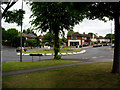
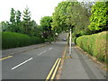
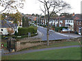
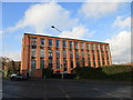
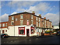
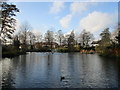
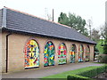
Photos of NG5 4LG


Area Information
NG5 4LG represents a very specific and compact residential cluster within England, covering an area of just 8,344 square metres. This small footprint serves a concentrated population of 1,347 residents, creating a tight-knit environment where neighbours are likely to know one another. The geography here is distinctively residential, bounded by precise postcode lines that define a practical boundary for daily life. Living in this zone means operating within a defined space where every street and property contributes to the overall character of the neighbourhood. The area size suggests a layout that is manageable on foot, allowing residents to access their immediate surroundings with ease. While the total area is small, the density of the people living here ensures that the community remains active and engaged. The postcode area is designed for housing rather than commercial sprawl, focusing the energy of 1,347 individuals into a compact, cohesive setting. Prospective buyers must understand that they are entering a specific slice of the wider locality, defined by these exact boundaries and population figures. The community operates on a scale where local facilities serve a focused group, ensuring that services are concentrated rather than spread thin across a vast distance.
- Area Type
- Postcode
- Area Size
- 8344 m²
- Population
- 1347
- Population Density
- 4554 people/km²
The property market in NG5 4LG is characterised by ownership rates that are unusually high for any significant residential zone in the UK. With 94% home ownership, the area functions overwhelmingly as an owner-occupied market rather than a rental hub. This statistic implies that the vast majority of the 1,347 residents own the homes they inhabit, leading to a stable housing stock with low turnover. The predominant accommodation type consists of houses, which suggests that terraced flats or high-rise apartments are virtually absent from this specific postcode. Buyers looking at NG5 4LG should expect a landscape of detached or semi-detached family homes rather than urban dwelling blocks. This market structure protects residents from the volatility of the private rental sector, where landlords can alter conditions or relocate unexpectedly. The high ownership percentage also indicates strong demand for purchasing properties in this specific cluster, driven by locals seeking to stay rather than float. Investing in homes in NG5 4LG means joining a community where selling pressure is generally lower than in areas with high rental yields or frequent student migration. The housing stock reflects the needs of the 30 to 64 age demographic, prioritising stability and space over the high-density living found in university towns or city centres.
House Prices in NG5 4LG
Showing 16 properties
| Address | Type | Beds | Baths | Last Sale Price | Last Sale Date | |
|---|---|---|---|---|---|---|
| 9 Coningsby Road, Woodthorpe, NG5 4LG | house | 3 | 1 | £400,000 | Oct 2025 | |
| 6 Coningsby Road, Woodthorpe, NG5 4LG | Detached | 3 | 1 | £400,000 | Apr 2024 | |
| 7 Coningsby Road, Woodthorpe, NG5 4LG | house | 5 | - | £456,000 | Nov 2021 | |
| 11 Coningsby Road, Woodthorpe, NG5 4LG | house | - | - | £335,000 | Apr 2021 | |
| 4 Coningsby Road, Woodthorpe, NG5 4LG | Detached | 5 | - | £315,000 | Apr 2014 | |
| 16 Coningsby Road, Woodthorpe, NG5 4LG | Detached | - | - | £230,000 | Oct 2006 | |
| 12 Coningsby Road, Woodthorpe, NG5 4LG | Detached | - | - | £194,500 | Jun 2003 | |
| 1 Coningsby Road, Woodthorpe, NG5 4LG | Detached | - | - | £172,000 | Jul 2002 | |
| 14 Coningsby Road, Woodthorpe, NG5 4LG | Detached | - | - | £164,000 | Feb 2002 | |
| 5 Coningsby Road, Woodthorpe, NG5 4LG | Detached | - | - | £102,000 | Jun 1999 |
Energy Efficiency in NG5 4LG
Daily life in NG5 4LG relies on a network of nearby amenities that are all within practical reach of residents. A total of five retail locations serve the local community, anchored by notable outlets such as Sainsburys Arnold, Co-op Mapperley, and Sainsburys Mapperley Breck. These supermarkets provide essential goods without the need for residents to travel into city centres. For commuters accessing the tram network, five metro stops are available, including Basford Tram Stop, David Lane Tram Stop, and Beaconsfield Street Tram Stop. These stops integrate seamlessly with the wider transport system, making day-to-day travel efficient. Approximately five rail stations are nearby, meaning Carlton Railway Station, Bulwell Railway Station, and Netherfield Railway Station are just a short journey away. These stations offer frequent departures to Manchester, Birmingham, and London, ensuring that business trips or family visits are accessible. For air travel, Nottingham Airport is located nearby, providing additional flexibility for residents who may need to fly. This dense network of shops and transport hubs means that living in NG5 4LG offers convenience without sacrifice. Residents can handle their weekly shopping, commute by train, or catch a flight without leaving the immediate vicinity of their homes.
Amenities
Schools
| Rank | School | Type | Entry gender | Ages |
|---|
Explore more schools in this area
Go to Schools tabDemographics
The community in NG5 4LG is defined by a mature demographic profile, with a median age of 47 years. The most common age range consists of adults between 30 and 64 years, indicating a population that has typically progressed beyond their early career stages. Home ownership stands at an exceptionally high level of 94%, suggesting a settled population with long-term roots in the neighbourhood. Almost every household in this postcode possesses its own property, reflecting a culture of stability. The primary accommodation type found here is houses, which aligns with the preferences of the older adult demographic seeking space and permanence. The predominant ethnic group is White, though the area likely benefits from the diversity common to the wider Nottinghamshire region. This high rate of ownership means that residents are less likely to be forced to move frequently due to rental periods or migrations tied to employment contracts. The age profile suggests a community that values established homes over new developments, with fewer people under the typical prime family formation age bracket. Living here appeals to those seeking a mature environment where neighbours have likely been part of the community for decades. The demographic makeup points away from a student-heavy or transient population, favouring families and empty nesters who have put down permanent stakes in the local real estate market.
Household Size
Accommodation Type
Tenure
Ethnic Group
Religion
Household Composition
Age
Household Deprivation
NS-SEC
Explore more demographic insights in this area
Go to Demographics tabPlanning
Planning Constraints
- Flood RiskPremium
- Ramsar Wetland SitesPremium
- Area of Outstanding Natural BeautyPremium
- Protected Nature ReservePremium
- Protected WoodlandPremium