Area Overview for NG5 2EJ
Photos of NG5 2EJ
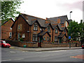

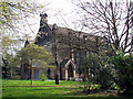
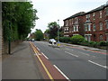
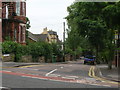
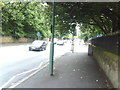
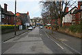
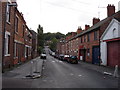
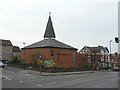
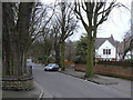
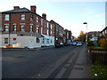
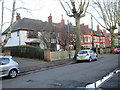
100 photos from this area
Area Information
Key information about the NG5 2EJ including its size, population, and administrative classification.
- Area Type
- Postcode
- Area Size
- 2.1 hectares
- Population
- 1618
- Population Density
- 4246 people/km²
House Prices in NG5 2EJ
35
Properties
£252,038
Average Sold Price
£46,000
Lowest Price
£515,000
Highest Price
Showing 35 properties
| Address | Type | Beds | Baths | Last Sale Price | Last Sale Date | |
|---|---|---|---|---|---|---|
| 394 Mansfield Road, Nottingham, NG5 2EJ | Detached | 6 | 3 | £515,000 | Mar 2024 | |
| 434 Mansfield Road, Nottingham, NG5 2EJ | Maisonette | 2 | 1 | £155,000 | Feb 2024 | |
| 404 Mansfield Road, Nottingham, NG5 2EJ | Detached | 5 | 3 | £350,000 | Jan 2024 | |
| 420 Mansfield Road, Nottingham, NG5 2EJ | Bungalow | 3 | 1 | £360,000 | Aug 2021 | |
| 432 Mansfield Road, Nottingham, NG5 2EJ | Flat | 2 | - | £117,500 | Mar 2020 | |
| 436 Mansfield Road, Nottingham, NG5 2EJ | Maisonette | 2 | 1 | £106,000 | Dec 2018 | |
| 424 Mansfield Road, Nottingham, NG5 2EJ | house | 4 | - | £368,000 | Oct 2012 | |
| 400A Mansfield Road, Nottingham, NG5 2EJ | Flat | 1 | 1 | £247,000 | Jan 2004 | |
| 408 Mansfield Road, Nottingham, NG5 2EJ | Semi-detached | - | - | £400,000 | Apr 2003 | |
| 426 Mansfield Road, Nottingham, NG5 2EJ | Detached | - | - | £268,000 | Mar 2002 |
Page 1 of 4
Energy Efficiency in NG5 2EJ
Amenities
Schools
| Rank | School | Type | Entry gender | Ages |
|---|
Explore more schools in this area
Go to Schools tabDemographics
Household Size
One person
most common
Accommodation Type
Houses
most common
Tenure
62
majority
Ethnic Group
White
most common
Religion
N/A
most common
Household Composition
N/A
most common
Age
47
median
Adults (30-64 years)
most common
Household Deprivation
N/A
with no deprivation
NS-SEC
46
in Lower managerial occupations
Explore more demographic insights in this area
Go to Demographics tabPlanning
Planning Constraints
- Flood RiskPremium
- Ramsar Wetland SitesPremium
- Area of Outstanding Natural BeautyPremium
- Protected Nature ReservePremium
- Protected WoodlandPremium