Area Overview for NG5 2AS
Photos of NG5 2AS
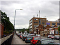
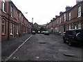

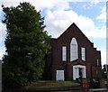
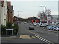
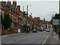
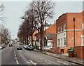

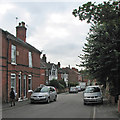
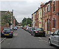
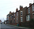
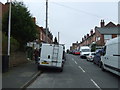
100 photos from this area
Area Information
Key information about the NG5 2AS including its size, population, and administrative classification.
- Area Type
- Postcode
- Area Size
- 5297 m²
- Population
- 1513
- Population Density
- 7179 people/km²
House Prices in NG5 2AS
35
Properties
£160,288
Average Sold Price
£45,000
Lowest Price
£357,500
Highest Price
Showing 35 properties
| Address | Type | Beds | Baths | Last Sale Price | Last Sale Date | |
|---|---|---|---|---|---|---|
| 49 Church Drive, Nottingham, NG5 2AS | house | - | - | £125,000 | Oct 2025 | |
| 71 Church Drive, Nottingham, NG5 2AS | Terraced | 2 | 1 | £175,000 | Jul 2024 | |
| 1 Church Drive, Nottingham, NG5 2AS | Terraced | 4 | 1 | £261,000 | Apr 2024 | |
| 65 Church Drive, Nottingham, NG5 2AS | Terraced | 3 | 1 | £276,000 | Mar 2023 | |
| 53 Church Drive, Nottingham, NG5 2AS | house | - | - | £168,000 | Nov 2021 | |
| 13 Church Drive, Nottingham, NG5 2AS | house | 1 | 2 | £357,500 | Nov 2021 | |
| 39 Church Drive, Nottingham, NG5 2AS | house | - | - | £160,000 | Jul 2021 | |
| 47 Church Drive, Nottingham, NG5 2AS | house | - | - | £169,000 | Dec 2017 | |
| 35 Church Drive, Nottingham, NG5 2AS | Semi-detached | 3 | 2 | £215,000 | Apr 2017 | |
| 63 Church Drive, Nottingham, NG5 2AS | Terraced | 3 | - | £179,950 | Feb 2016 |
Page 1 of 4
Energy Efficiency in NG5 2AS
Amenities
Schools
| Rank | School | Type | Entry gender | Ages |
|---|
Explore more schools in this area
Go to Schools tabDemographics
Household Size
One person
most common
Accommodation Type
Houses
most common
Tenure
45
majority
Ethnic Group
White
most common
Religion
N/A
most common
Household Composition
N/A
most common
Age
47
median
Adults (30-64 years)
most common
Household Deprivation
N/A
with no deprivation
NS-SEC
41
in Lower managerial occupations
Explore more demographic insights in this area
Go to Demographics tabPlanning
Planning Constraints
- Flood RiskPremium
- Ramsar Wetland SitesPremium
- Area of Outstanding Natural BeautyPremium
- Protected Nature ReservePremium
- Protected WoodlandPremium