Area Overview for NG5 1GQ
Photos of NG5 1GQ
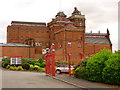
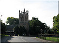
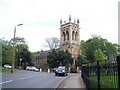
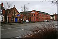
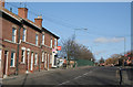
100 photos from this area
Area Information
Key information about the NG5 1GQ including its size, population, and administrative classification.
- Area Type
- Postcode
- Area Size
- 2.2 hectares
- Population
- 1772
- Population Density
- 6044 people/km²
House Prices in NG5 1GQ
29
Properties
£148,329
Average Sold Price
£41,500
Lowest Price
£265,000
Highest Price
Showing 29 properties
| Address | Type | Beds | Baths | Last Sale Price | Last Sale Date | |
|---|---|---|---|---|---|---|
| 305 Perry Road, Nottingham, NG5 1GQ | Detached | 3 | 1 | £265,000 | Oct 2025 | |
| 299 Perry Road, Nottingham, NG5 1GQ | Semi-detached | 3 | 2 | £170,000 | Mar 2025 | |
| 283 Perry Road, Nottingham, NG5 1GQ | Semi-detached | 3 | 1 | £260,000 | Jul 2023 | |
| 287 Perry Road, Nottingham, NG5 1GQ | Retail | 3 | 1 | £230,000 | May 2022 | |
| 333 Perry Road, Nottingham, NG5 1GQ | house | - | - | £166,000 | May 2021 | |
| 337 Perry Road, Nottingham, NG5 1GQ | house | - | - | £170,000 | May 2019 | |
| 301 Perry Road, Nottingham, NG5 1GQ | Semi-detached | 3 | 1 | £151,600 | Feb 2018 | |
| 329 Perry Road, Nottingham, NG5 1GQ | Semi-detached | 3 | - | £121,000 | Jan 2013 | |
| 315 Perry Road, Nottingham, NG5 1GQ | Semi-detached | - | - | £110,000 | Apr 2010 | |
| 323 Perry Road, Nottingham, NG5 1GQ | Semi-detached | - | - | £110,000 | Feb 2010 |
Page 1 of 3
Energy Efficiency in NG5 1GQ
Amenities
Schools
| Rank | School | Type | Entry gender | Ages |
|---|
Explore more schools in this area
Go to Schools tabDemographics
Household Size
Family (3-5 people)
most common
Accommodation Type
Houses
most common
Tenure
77
majority
Ethnic Group
White
most common
Religion
N/A
most common
Household Composition
N/A
most common
Age
47
median
Adults (30-64 years)
most common
Household Deprivation
N/A
with no deprivation
NS-SEC
33
in Lower managerial occupations
Explore more demographic insights in this area
Go to Demographics tabPlanning
Planning Constraints
- Flood RiskPremium
- Ramsar Wetland SitesPremium
- Area of Outstanding Natural BeautyPremium
- Protected Nature ReservePremium
- Protected WoodlandPremium