Area Overview for NG4 4PN
Photos of NG4 4PN
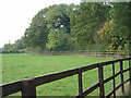

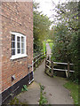
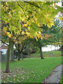
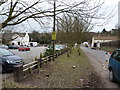
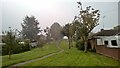
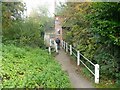
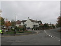
73 photos from this area
Area Information
Key information about the NG4 4PN including its size, population, and administrative classification.
- Area Type
- Postcode
- Area Size
- 3.6 hectares
- Population
- 2493
- Population Density
- 276 people/km²
House Prices in NG4 4PN
33
Properties
£283,267
Average Sold Price
£135,000
Lowest Price
£425,000
Highest Price
Showing 33 properties
| Address | Type | Beds | Baths | Last Sale Price | Last Sale Date | |
|---|---|---|---|---|---|---|
| 39 Main Street, Lambley, NG4 4PN | house | - | - | £268,000 | Jul 2021 | |
| 29 Main Street, Lambley, NG4 4PN | house | - | - | £250,000 | Nov 2020 | |
| 27 Main Street, Lambley, NG4 4PN | house | 2 | 1 | £135,000 | Nov 2020 | |
| 25 Main Street, Lambley, NG4 4PN | Terraced | 2 | 1 | £150,000 | Nov 2020 | |
| 51 Main Street, Lambley, NG4 4PN | Detached | 7 | 5 | £400,000 | Sep 2020 | |
| 18 Main Street, Lambley, NG4 4PN | Cottage | 3 | 1 | £245,000 | Jun 2019 | |
| 31 Main Street, Lambley, NG4 4PN | Cottage | 4 | 1 | £275,000 | Jan 2019 | |
| 55 Main Street, Lambley, NG4 4PN | Bungalow | - | - | £370,000 | Jan 2018 | |
| 24 Main Street, Lambley, NG4 4PN | Flat | - | 1 | £420,000 | Jul 2017 | |
| 16 Main Street, Lambley, NG4 4PN | house | 4 | 4 | £425,000 | Nov 2014 |
Page 1 of 4
Energy Efficiency in NG4 4PN
Amenities
Schools
| Rank | School | Type | Entry gender | Ages |
|---|
Explore more schools in this area
Go to Schools tabDemographics
Household Size
Two person
most common
Accommodation Type
Houses
most common
Tenure
86
majority
Ethnic Group
White
most common
Religion
N/A
most common
Household Composition
N/A
most common
Age
47
median
Adults (30-64 years)
most common
Household Deprivation
N/A
with no deprivation
NS-SEC
42
in Lower managerial occupations
Explore more demographic insights in this area
Go to Demographics tabPlanning
Planning Constraints
- Flood RiskPremium
- Ramsar Wetland SitesPremium
- Area of Outstanding Natural BeautyPremium
- Protected Nature ReservePremium
- Protected WoodlandPremium