Area Overview for NG4 3NH
Photos of NG4 3NH
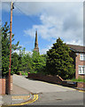
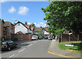
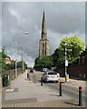
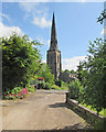
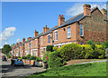
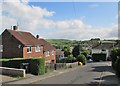
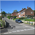
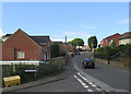
95 photos from this area
Area Information
Key information about the NG4 3NH including its size, population, and administrative classification.
- Area Type
- Postcode
- Area Size
- 7522 m²
- Population
- 1553
- Population Density
- 5921 people/km²
House Prices in NG4 3NH
18
Properties
£143,596
Average Sold Price
£37,000
Lowest Price
£350,000
Highest Price
Showing 18 properties
| Address | Type | Beds | Baths | Last Sale Price | Last Sale Date | |
|---|---|---|---|---|---|---|
| 128 Westdale Lane East, Gedling, NG4 3NH | Detached | 3 | 1 | £288,000 | Sep 2024 | |
| 112 Westdale Lane East, Gedling, NG4 3NH | Flat | 2 | 1 | £140,000 | Aug 2024 | |
| 130 Westdale Lane East, Gedling, NG4 3NH | Detached | 3 | 1 | £350,000 | Jun 2024 | |
| 104 Westdale Lane East, Gedling, NG4 3NH | house | - | - | £142,500 | Feb 2012 | |
| 108 Westdale Lane East, Gedling, NG4 3NH | Detached | - | - | £156,000 | May 2008 | |
| 118 Westdale Lane East, Gedling, NG4 3NH | house | - | - | £196,000 | Sep 2006 | |
| 126 Westdale Lane East, Gedling, NG4 3NH | Detached | - | - | £165,000 | Mar 2004 | |
| 120 Westdale Lane East, Gedling, NG4 3NH | Detached | 3 | - | £77,200 | Jun 2000 | |
| 116 Westdale Lane East, Gedling, NG4 3NH | Maisonette | - | - | £39,000 | Dec 1999 | |
| 106 Westdale Lane East, Gedling, NG4 3NH | Semi-detached | - | - | £62,500 | Nov 1999 |
Page 1 of 2
Energy Efficiency in NG4 3NH
Amenities
Schools
| Rank | School | Type | Entry gender | Ages |
|---|
Explore more schools in this area
Go to Schools tabDemographics
Household Size
Two person
most common
Accommodation Type
Houses
most common
Tenure
86
majority
Ethnic Group
White
most common
Religion
N/A
most common
Household Composition
N/A
most common
Age
47
median
Adults (30-64 years)
most common
Household Deprivation
N/A
with no deprivation
NS-SEC
33
in Lower managerial occupations
Explore more demographic insights in this area
Go to Demographics tabPlanning
Planning Constraints
- Flood RiskPremium
- Ramsar Wetland SitesPremium
- Area of Outstanding Natural BeautyPremium
- Protected Nature ReservePremium
- Protected WoodlandPremium