Area Overview for NG4 2EB
Photos of NG4 2EB


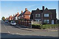


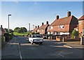

73 photos from this area
Area Information
Key information about the NG4 2EB including its size, population, and administrative classification.
- Area Type
- Postcode
- Area Size
- 9727 m²
- Population
- 1123
- Population Density
- 2755 people/km²
House Prices in NG4 2EB
11
Properties
£150,257
Average Sold Price
£83,000
Lowest Price
£224,000
Highest Price
Showing 11 properties
| Address | Type | Beds | Baths | Last Sale Price | Last Sale Date | |
|---|---|---|---|---|---|---|
| 72 Vale Road, Colwick, NG4 2EB | Semi-detached | 2 | 2 | £224,000 | Feb 2025 | |
| 74 Vale Road, Colwick, NG4 2EB | Semi-detached | 3 | 1 | £170,000 | May 2024 | |
| 86 Vale Road, Colwick, NG4 2EB | Detached | - | - | £182,800 | Apr 2022 | |
| 70 Vale Road, Colwick, NG4 2EB | Semi-detached | 3 | 1 | £180,000 | Jan 2018 | |
| 84 Vale Road, Colwick, NG4 2EB | Detached | 4 | 2 | £127,000 | May 2003 | |
| 233 Vale Road, Colwick, NG4 2EB | Semi-detached | - | - | £83,000 | Jun 2002 | |
| 68 Vale Road, Colwick, NG4 2EB | Semi-detached | - | - | £85,000 | Apr 2002 | |
| 66A Vale Road, Colwick, NG4 2EB | Flat | - | - | - | - | |
| 235 Vale Road, Colwick, NG4 2EB | house | - | - | - | - | |
| 239 Vale Road, Colwick, NG4 2EB | Semi-detached | - | - | - | - |
Page 1 of 2
Energy Efficiency in NG4 2EB
Amenities
Schools
| Rank | School | Type | Entry gender | Ages |
|---|
Explore more schools in this area
Go to Schools tabDemographics
Household Size
Two person
most common
Accommodation Type
Houses
most common
Tenure
85
majority
Ethnic Group
White
most common
Religion
N/A
most common
Household Composition
N/A
most common
Age
47
median
Adults (30-64 years)
most common
Household Deprivation
N/A
with no deprivation
NS-SEC
41
in Lower managerial occupations
Explore more demographic insights in this area
Go to Demographics tabPlanning
Planning Constraints
- Flood RiskPremium
- Ramsar Wetland SitesPremium
- Area of Outstanding Natural BeautyPremium
- Protected Nature ReservePremium
- Protected WoodlandPremium