Area Overview for NG4 1HU
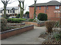
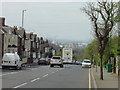
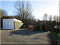
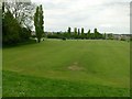
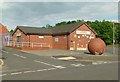
Photos of NG4 1HU

Area Information
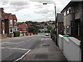
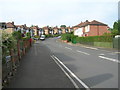
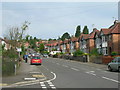
Living in NG4 1HU offers a settled residential experience within a cluster of just 1,319 people. This sizeable enough yet intimate community ensures you are part of a defined neighbourhood rather than a faceless city district. The area consists primarily of houses, creating a streetscape dominated by private gardens and detached or semi-detached properties. Your daily life balances quiet domesticity with convenient access to Nottingham's wider infrastructure. You are close to local essentials without being overwhelmed by urban density. The location sits at the intersection of practical living and modern connectivity. While the population is relatively static, the housing stock reflects established families who have put down roots. You will find that life here moves at a steady pace, driven by the routines of a predominantly owner-occupied community. The area avoids the chaos of major transport hubs while remaining minutes away from them. This balance makes it a pragmatic choice for those seeking stability. The environment is free from significant planning constraints like protected wetlands or woodlands, offering straightforward building regulations for any future home improvements you might consider. It is a functional, stabile microcosm of suburban life on the edge of Nottingham.
- Area Type
- Postcode
- Area Size
- Not available
- Population
- 1319
- Population Density
- 5448 people/km²
The property market in NG4 1HU is characterised by a strong owner-occupier base. With 62% of homes owned by residents, the area functions less like a city centre rental market and more like a traditional suburb. Houses account for the vast majority of the stock, meaning you will see detached and semi-detached properties rather than flats or purpose-built blocks. This housing style appeals to families or couples looking for space and privacy. The small population of 1,319 dictates a limited inventory, which often means properties move slower than in larger commercial zones. Buyers here are typically looking for established digs rather than new builds, as the local planning constraints are minimal or non-existent. There are no Ramsar wetland sites, Areas of Outstanding Natural Beauty, or protected nature reserves imposing strict limits on development. This makes the area straightforward for those considering similar housing needs in the future. You should approach the market here as a private residential investment. The high ownership rate indicates strong local attachment, which can suppress quick price drops when properties become available. You are competing with residents who value their homes deeply and prefer to stay.
House Prices in NG4 1HU
No properties found in this postcode.
Energy Efficiency in NG4 1HU
Your daily lifestyle in NG4 1HU revolves around a cluster of major retail and transport nodes nearby. You have five notable shopping destinations within practical reach, including Tesco Nottingham, Iceland Carlton, and Tesco Nottingham again listed as a distinct reference point. These supermarkets ensure you can stock up on groceries and essentials without travelling far. Transport connectivity is extensive, with five rail options including Netherfield Railway Station, Carlton Railway Station, and Nottingham Railway Station. You can catch a train quickly to arrive at work or leisure destinations city-wide. Nearby tram stops at Lace Market, Royal Centre, and Old Market Square connect you directly to the city core. There is also a single airport option, Nottingham Airport, providing flight connections if you travel frequently. This proximity to five rail services and multiple tram stops means you are never cut off from the wider region. The combination of retail giants and multi-modal transport creates a convenient, low-friday commute daily life.
Amenities
Schools
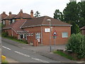
Families with children in NG4 1HU have access to Parkdale Primary School, a key facility in the immediate vicinity. This is a primary school that holds a Good rating from Ofsted, confirming it meets the government's standards for quality education. The presence of a single primary rated Good suggests that secondary education requires a short journey for school-age children. This mix means young families must plan their commutes to the nearest comprehensive or academy schools outside the immediate postcode cluster. The lack of a secondary school within the data does not diminish the quality of the local primary education you can secure. Parkdale Primary School provides a recognised foundation for your children's early years. You will need to research transport links to secondary options separately, as the data only empowers you to confirm primary provision. The Good rating is a significant asset for parents inspecting homes for their offspring. It guarantees that the first chapter of your child's education is in capable hands nearby.
| Rank | School | Type | Entry gender | Ages |
|---|
Explore more schools in this area
Go to Schools tabDemographics
The community in NG4 1HU is defined by maturity and stability. The median age stands at 47, firmly placing Adults aged 30 to 64 years as the most common demographic. This age profile suggests a population with established careers and families in the planning stages. Home ownership is high, with 62% of residents owning their properties outright or with a mortgage. This figure confirms that the area is not a student or transient rental zone but a place for long-term settlement. Houses dominate the accommodation mix, reinforcing the family-oriented character of the streets. The predominant ethnic group is White, creating a culturally homogenous environment where neighbours likely share similar backgrounds. There is no data regarding severe deprivation, and the absence of such negative indicators supports the area's stable reputation. A rental yield here would likely reflect this low turnover rather than high demand from young professionals. The demographic makeup tells you that this is a quiet street where neighbours know each other's names. You are unlikely to find a churn of temporary residents moving in and out frequently. Instead, you will encounter a settled crowd invested in the future of their homes and their local高德 roads.
Household Size
Accommodation Type
Tenure
Ethnic Group
Religion
Household Composition
Age
Household Deprivation
NS-SEC
Explore more demographic insights in this area
Go to Demographics tabPlanning
Planning Constraints
- Flood RiskPremium
- Ramsar Wetland SitesPremium
- Area of Outstanding Natural BeautyPremium
- Protected Nature ReservePremium
- Protected WoodlandPremium