Area Overview for NG34 8HZ
Photos of NG34 8HZ


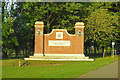
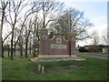
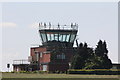


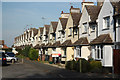

10 photos from this area
Area Information
Key information about the NG34 8HZ including its size, population, and administrative classification.
- Area Type
- Postcode
- Area Size
- 26.0 hectares
- Population
- 1470
- Population Density
- 45 people/km²
House Prices in NG34 8HZ
25
Properties
£89,095
Average Sold Price
£25,000
Lowest Price
£155,000
Highest Price
Showing 25 properties
| Address | Type | Beds | Baths | Last Sale Price | Last Sale Date | |
|---|---|---|---|---|---|---|
| 1 Flowerdown Avenue, Cranwell, Sleaford, NG34 8HZ | Terraced | 2 | 1 | £149,950 | Aug 2024 | |
| 16 Flowerdown Avenue, Cranwell, Sleaford, NG34 8HZ | Terraced | 2 | 1 | £155,000 | Jul 2024 | |
| 3 Flowerdown Avenue, Cranwell, Sleaford, NG34 8HZ | house | 2 | 2 | £136,500 | May 2022 | |
| 21 Flowerdown Avenue, Cranwell, Sleaford, NG34 8HZ | Terraced | 2 | 1 | £138,000 | Feb 2022 | |
| 10 Flowerdown Avenue, Cranwell, Sleaford, NG34 8HZ | Terraced | 2 | 1 | £113,000 | Dec 2020 | |
| 6 Flowerdown Avenue, Cranwell, Sleaford, NG34 8HZ | Terraced | 2 | 1 | £124,000 | Jul 2020 | |
| 1A Flowerdown Avenue, Cranwell, Sleaford, NG34 8HZ | Semi-detached | 3 | 1 | £150,000 | Nov 2019 | |
| 5 Flowerdown Avenue, Cranwell, Sleaford, NG34 8HZ | Terraced | 2 | 1 | £90,000 | Oct 2017 | |
| 7 Flowerdown Avenue, Cranwell, Sleaford, NG34 8HZ | Terraced | 2 | 1 | £87,000 | Mar 2016 | |
| 11 Flowerdown Avenue, Cranwell, Sleaford, NG34 8HZ | Terraced | 2 | - | £90,000 | Aug 2015 |
Page 1 of 3
Energy Efficiency in NG34 8HZ
Amenities
Schools
| Rank | School | Type | Entry gender | Ages |
|---|
Explore more schools in this area
Go to Schools tabDemographics
Household Size
Two person
most common
Accommodation Type
Houses
most common
Tenure
76
majority
Ethnic Group
White
most common
Religion
N/A
most common
Household Composition
N/A
most common
Age
47
median
Adults (30-64 years)
most common
Household Deprivation
N/A
with no deprivation
NS-SEC
34
in Lower managerial occupations
Explore more demographic insights in this area
Go to Demographics tabPlanning
Planning Constraints
- Flood RiskPremium
- Ramsar Wetland SitesPremium
- Area of Outstanding Natural BeautyPremium
- Protected Nature ReservePremium
- Protected WoodlandPremium