Area Overview for NG33 4SW
Photos of NG33 4SW
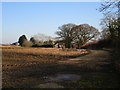
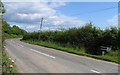
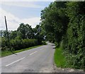

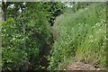
13 photos from this area
Area Information
Key information about the NG33 4SW including its size, population, and administrative classification.
- Area Type
- Postcode
- Area Size
- 1.6 km²
- Population
- 1241
- Population Density
- 44 people/km²
House Prices in NG33 4SW
10
Properties
£767,500
Average Sold Price
£550,000
Lowest Price
£985,000
Highest Price
Showing 10 properties
| Address | Type | Beds | Baths | Last Sale Price | Last Sale Date | |
|---|---|---|---|---|---|---|
| Pepperidge Farm, Morkery Lane, Castle Bytham, NG33 4SW | house | 6 | 4 | £550,000 | May 2023 | |
| Old Quarry House, Morkery Lane, Castle Bytham, NG33 4SW | house | - | - | £985,000 | Oct 2022 | |
| Farmhouse, Angel Wells Farm, Morkery Lane, Castle Bytham, NG33 4SW | Farm | 2 | 1 | - | - | |
| The Bungalow, Angel Wells Farm, Morkery Lane, Castle Bytham, NG33 4SW | Bungalow | 2 | 1 | - | - | |
| Caravan At Owls Lodge, Morkery Lane, Castle Bytham, NG33 4SW | Mobile Home | - | - | - | - | |
| Annexe, Pepperidge Farm, Morkery Lane, Castle Bytham, NG33 4SW | Flat | - | - | - | - | |
| Steel Barn, Morkery Lane, Castle Bytham, NG33 4SW | Detached | - | - | - | - | |
| Barn Opposite Access Road To Potter's Hill Farm, Morkery Lane, Castle Bytham, NG33 4SW | Farm | - | - | - | - | |
| Stables And Equestrian Land, Angel Wells Farm, Morkery Lane, Castle Bytham, NG33 4SW | Equestrian | - | - | - | - | |
| Angel Wells Farm, Morkery Lane, Castle Bytham, NG33 4SW | Bungalow | - | - | - | - |
Energy Efficiency in NG33 4SW
Amenities
Schools
| Rank | School | Type | Entry gender | Ages |
|---|
Explore more schools in this area
Go to Schools tabDemographics
Household Size
Two person
most common
Accommodation Type
Houses
most common
Tenure
77
majority
Ethnic Group
White
most common
Religion
N/A
most common
Household Composition
N/A
most common
Age
47
median
Adults (30-64 years)
most common
Household Deprivation
N/A
with no deprivation
NS-SEC
37
in Lower managerial occupations
Explore more demographic insights in this area
Go to Demographics tabPlanning
Planning Constraints
- Flood RiskPremium
- Ramsar Wetland SitesPremium
- Area of Outstanding Natural BeautyPremium
- Protected Nature ReservePremium
- Protected WoodlandPremium