Area Overview for NG33 4PA
Photos of NG33 4PA
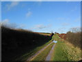
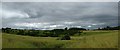
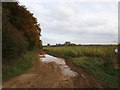
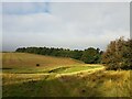
19 photos from this area
Area Information
Key information about the NG33 4PA including its size, population, and administrative classification.
- Area Type
- Postcode
- Area Size
- 2.6 km²
- Population
- 2426
- Population Density
- 24 people/km²
House Prices in NG33 4PA
40
Properties
£293,667
Average Sold Price
£178,000
Lowest Price
£530,000
Highest Price
Showing 40 properties
| Address | Type | Beds | Baths | Last Sale Price | Last Sale Date | |
|---|---|---|---|---|---|---|
| 46 High Street, Swinstead, NG33 4PA | Bungalow | 2 | 1 | £178,000 | Sep 2024 | |
| 14 High Street, Swinstead, NG33 4PA | Terraced | 4 | 2 | £530,000 | Oct 2022 | |
| 34 High Street, Swinstead, NG33 4PA | Bungalow | 3 | 1 | £225,000 | Apr 2021 | |
| 54 High Street, Swinstead, NG33 4PA | Semi-detached | 4 | 1 | £245,000 | Feb 2020 | |
| Chapel Barn House, 18 High Street, Swinstead, NG33 4PA | Terraced | - | - | £335,000 | Aug 2018 | |
| 10 High Street, Little Bytham, NG33 4PA | Detached | 4 | 5 | £249,000 | May 2016 | |
| April Cottage, 30 High Street, Swinstead, NG33 4PA | Retail | - | - | - | - | |
| The Old Barn, High Street, Swinstead, NG33 4PA | Detached | 5 | 2 | - | - | |
| 2 High Street, Swinstead, NG33 4PA | house | 3 | - | - | - | |
| Swinstead Cottage, 40 High Street, Swinstead, NG33 4PA | Cottage | 4 | 1 | - | - |
Page 1 of 4
Energy Efficiency in NG33 4PA
Amenities
Schools
| Rank | School | Type | Entry gender | Ages |
|---|
Explore more schools in this area
Go to Schools tabDemographics
Household Size
Two person
most common
Accommodation Type
Houses
most common
Tenure
67
majority
Ethnic Group
White
most common
Religion
N/A
most common
Household Composition
N/A
most common
Age
47
median
Adults (30-64 years)
most common
Household Deprivation
N/A
with no deprivation
NS-SEC
40
in Lower managerial occupations
Explore more demographic insights in this area
Go to Demographics tabPlanning
Planning Constraints
- Flood RiskPremium
- Ramsar Wetland SitesPremium
- Area of Outstanding Natural BeautyPremium
- Protected Nature ReservePremium
- Protected WoodlandPremium