Area Overview for NG33 4LW
Photos of NG33 4LW
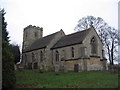
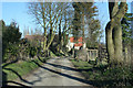
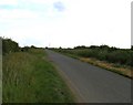

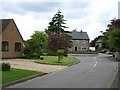
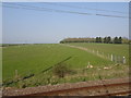
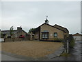
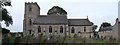
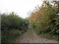
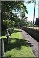
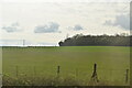
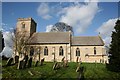
44 photos from this area
Area Information
Key information about the NG33 4LW including its size, population, and administrative classification.
- Area Type
- Postcode
- Area Size
- 11.7 hectares
- Population
- 2426
- Population Density
- 24 people/km²
House Prices in NG33 4LW
12
Properties
£391,750
Average Sold Price
£210,000
Lowest Price
£1,000,000
Highest Price
Showing 12 properties
| Address | Type | Beds | Baths | Last Sale Price | Last Sale Date | |
|---|---|---|---|---|---|---|
| 21 Castle Bytham Road, Swayfield, NG33 4LW | Detached | 3 | 2 | £210,000 | Sep 2025 | |
| Mulberry House, 17 Castle Bytham Road, Swayfield, NG33 4LW | Detached | 5 | 4 | £1,000,000 | Sep 2024 | |
| 19 Castle Bytham Road, Swayfield, NG33 4LW | house | - | - | £372,500 | Nov 2019 | |
| 3 Castle Bytham Road, Swayfield, NG33 4LW | Bungalow | 3 | 2 | £295,000 | Oct 2016 | |
| 13 Castle Bytham Road, Swayfield, NG33 4LW | Bungalow | 4 | 2 | £364,000 | Nov 2015 | |
| Dovestone, Castle Bytham Road, Swayfield, NG33 4LW | Detached | 3 | - | £320,000 | Jun 2012 | |
| 1 Castle Bytham Road, Swayfield, NG33 4LW | Detached | 5 | 2 | £300,000 | Dec 2010 | |
| 7 Castle Bytham Road, Swayfield, NG33 4LW | Detached | - | - | £272,500 | Sep 2007 | |
| Cedar House, 2A Castle Bytham Road, Swayfield, NG33 4LW | house | - | - | - | - | |
| Santona, 15 Castle Bytham Road, Swayfield, NG33 4LW | Detached | - | - | - | - |
Page 1 of 2
Energy Efficiency in NG33 4LW
Amenities
Schools
| Rank | School | Type | Entry gender | Ages |
|---|
Explore more schools in this area
Go to Schools tabDemographics
Household Size
Two person
most common
Accommodation Type
Houses
most common
Tenure
67
majority
Ethnic Group
White
most common
Religion
N/A
most common
Household Composition
N/A
most common
Age
47
median
Adults (30-64 years)
most common
Household Deprivation
N/A
with no deprivation
NS-SEC
40
in Lower managerial occupations
Explore more demographic insights in this area
Go to Demographics tabPlanning
Planning Constraints
- Flood RiskPremium
- Ramsar Wetland SitesPremium
- Area of Outstanding Natural BeautyPremium
- Protected Nature ReservePremium
- Protected WoodlandPremium