Area Overview for NG33 4HJ
Photos of NG33 4HJ
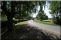
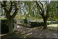
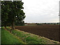
25 photos from this area
Area Information
Key information about the NG33 4HJ including its size, population, and administrative classification.
- Area Type
- Postcode
- Area Size
- 1.6 km²
- Population
- 2152
- Population Density
- 24 people/km²
House Prices in NG33 4HJ
10
Properties
£428,300
Average Sold Price
£45,000
Lowest Price
£900,000
Highest Price
Showing 10 properties
| Address | Type | Beds | Baths | Last Sale Price | Last Sale Date | |
|---|---|---|---|---|---|---|
| Inglenook Cottage, Lenton Road, Hanby, NG33 4HJ | Detached | 5 | 3 | £645,000 | Dec 2025 | |
| Dial Cottage, Lenton Road, Hanby, NG33 4HJ | house | 3 | - | £302,500 | Sep 2010 | |
| Hanby Grange, Hall Field Lane, Hanby, NG33 4HJ | Detached | 7 | 2 | £900,000 | Feb 2007 | |
| Western House, Lenton Road, Hanby, NG33 4HJ | Semi-detached | - | - | £249,000 | Aug 2006 | |
| Meadow View, Lenton Road, Hanby, NG33 4HJ | office_workshop | - | - | £45,000 | Aug 1998 | |
| The Holt, Hall Field Lane, Hanby, NG33 4HJ | Detached | 4 | - | - | - | |
| The Old Stables Grange Farm, Folkingham Road, Hanby, NG33 4HJ | Terraced | - | - | - | - | |
| Stillwaters, Hall Field Lane, Hanby, NG33 4HJ | Bungalow | - | - | - | - | |
| Equestrian Life, The Holt, Hall Field Lane, Hanby, NG33 4HJ | Equestrian | - | - | - | - | |
| Moat House, Hall Field Lane, Hanby, NG33 4HJ | house | - | - | - | - |
Energy Efficiency in NG33 4HJ
Amenities
Schools
| Rank | School | Type | Entry gender | Ages |
|---|
Explore more schools in this area
Go to Schools tabDemographics
Household Size
Two person
most common
Accommodation Type
Houses
most common
Tenure
78
majority
Ethnic Group
White
most common
Religion
N/A
most common
Household Composition
N/A
most common
Age
47
median
Adults (30-64 years)
most common
Household Deprivation
N/A
with no deprivation
NS-SEC
40
in Lower managerial occupations
Explore more demographic insights in this area
Go to Demographics tabPlanning
Planning Constraints
- Flood RiskPremium
- Ramsar Wetland SitesPremium
- Area of Outstanding Natural BeautyPremium
- Protected Nature ReservePremium
- Protected WoodlandPremium