Area Overview for NG32 2NH
Photos of NG32 2NH
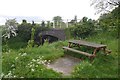
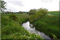
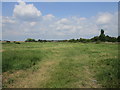
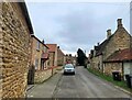
28 photos from this area
Area Information
Key information about the NG32 2NH including its size, population, and administrative classification.
- Area Type
- Postcode
- Area Size
- 24.2 hectares
- Population
- 1479
- Population Density
- 41 people/km²
House Prices in NG32 2NH
15
Properties
£339,375
Average Sold Price
£30,000
Lowest Price
£550,000
Highest Price
Showing 15 properties
| Address | Type | Beds | Baths | Last Sale Price | Last Sale Date | |
|---|---|---|---|---|---|---|
| Richmond House, Main Road, Barkston, NG32 2NH | Detached | 3 | 2 | £425,000 | May 2023 | |
| Tagmoor, Main Road, Barkston, NG32 2NH | Bungalow | 3 | 2 | £312,500 | Mar 2022 | |
| Virginia House, Main Road, Barkston, NG32 2NH | Detached | 5 | 2 | £550,000 | Dec 2021 | |
| Warradale, Main Road, Barkston, NG32 2NH | Bungalow | 3 | 2 | £303,500 | Apr 2019 | |
| Buntin House, Main Road, Barkston, NG32 2NH | Cottage | 4 | 2 | £299,000 | Feb 2019 | |
| Eagle House, Main Road, Barkston, NG32 2NH | Detached | 5 | - | £345,000 | Oct 2017 | |
| Barkston House, Main Road, Barkston, NG32 2NH | Detached | - | - | £450,000 | Feb 1999 | |
| Grange View, Main Road, Barkston, NG32 2NH | Bungalow | 3 | 2 | £30,000 | Jan 1999 | |
| Briardene, Main Road, Barkston, NG32 2NH | Bungalow | 3 | 1 | - | - | |
| The Poppies, Main Road, Barkston, NG32 2NH | Detached | 4 | 2 | - | - |
Page 1 of 2
Energy Efficiency in NG32 2NH
Amenities
Schools
| Rank | School | Type | Entry gender | Ages |
|---|
Explore more schools in this area
Go to Schools tabDemographics
Household Size
Two person
most common
Accommodation Type
Houses
most common
Tenure
80
majority
Ethnic Group
White
most common
Religion
N/A
most common
Household Composition
N/A
most common
Age
47
median
Adults (30-64 years)
most common
Household Deprivation
N/A
with no deprivation
NS-SEC
39
in Lower managerial occupations
Explore more demographic insights in this area
Go to Demographics tabPlanning
Planning Constraints
- Flood RiskPremium
- Ramsar Wetland SitesPremium
- Area of Outstanding Natural BeautyPremium
- Protected Nature ReservePremium
- Protected WoodlandPremium