Area Overview for NG32 1HW
Photos of NG32 1HW
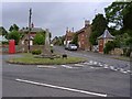
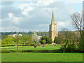
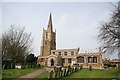
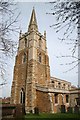
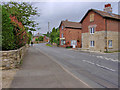
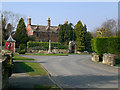

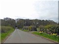
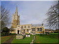
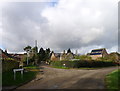
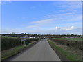
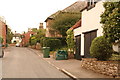
100 photos from this area
Area Information
Key information about the NG32 1HW including its size, population, and administrative classification.
- Area Type
- Postcode
- Area Size
- 3.2 hectares
- Population
- 2201
- Population Density
- 37 people/km²
House Prices in NG32 1HW
14
Properties
£375,686
Average Sold Price
£50,000
Lowest Price
£920,000
Highest Price
Showing 14 properties
| Address | Type | Beds | Baths | Last Sale Price | Last Sale Date | |
|---|---|---|---|---|---|---|
| 9A Pond Street, Harlaxton, NG32 1HW | house | - | - | £610,000 | Jun 2021 | |
| Waterlilies, 11 Pond Street, Harlaxton, NG32 1HW | Detached | 6 | 5 | £920,000 | Jun 2020 | |
| White Farm Cottage, 16 Pond Street, Harlaxton, NG32 1HW | Cottage | 4 | 2 | £485,000 | Oct 2017 | |
| 8 Pond Street, Harlaxton, NG32 1HW | Bungalow | 4 | 1 | £229,000 | Jul 2015 | |
| Sans Souci, 14 Pond Street, Harlaxton, NG32 1HW | Bungalow | 3 | - | £245,000 | Jul 2014 | |
| 1 Pond Street, Harlaxton, NG32 1HW | Detached | - | - | £380,000 | Feb 2014 | |
| Cornridge, 10 Pond Street, Harlaxton, NG32 1HW | house | 3 | - | £422,500 | Jul 2010 | |
| Piran House, 5 Pond Street, Harlaxton, NG32 1HW | Bungalow | 2 | - | £285,047 | Jun 2010 | |
| 9 Pond Street, Harlaxton, NG32 1HW | Detached | - | - | £355,000 | Jul 2006 | |
| 6 Pond Street, Harlaxton, NG32 1HW | Detached | - | - | £50,000 | Jul 1997 |
Page 1 of 2
Energy Efficiency in NG32 1HW
Amenities
Schools
| Rank | School | Type | Entry gender | Ages |
|---|
Explore more schools in this area
Go to Schools tabDemographics
Household Size
Two person
most common
Accommodation Type
Houses
most common
Tenure
57
majority
Ethnic Group
White
most common
Religion
N/A
most common
Household Composition
N/A
most common
Age
47
median
Adults (30-64 years)
most common
Household Deprivation
N/A
with no deprivation
NS-SEC
37
in Lower managerial occupations
Explore more demographic insights in this area
Go to Demographics tabPlanning
Planning Constraints
- Flood RiskPremium
- Ramsar Wetland SitesPremium
- Area of Outstanding Natural BeautyPremium
- Protected Nature ReservePremium
- Protected WoodlandPremium