Area Overview for NG31 9TR
Photos of NG31 9TR
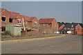
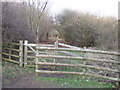
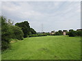
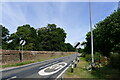
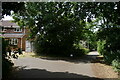
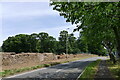
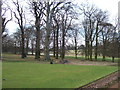
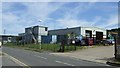
12 photos from this area
Area Information
Key information about the NG31 9TR including its size, population, and administrative classification.
- Area Type
- Postcode
- Area Size
- 8977 m²
- Population
- 2040
- Population Density
- 136 people/km²
House Prices in NG31 9TR
19
Properties
£123,258
Average Sold Price
£55,175
Lowest Price
£190,000
Highest Price
Showing 19 properties
| Address | Type | Beds | Baths | Last Sale Price | Last Sale Date | |
|---|---|---|---|---|---|---|
| 14 Third Avenue, Grantham, NG31 9TR | Semi-detached | 3 | 1 | £152,000 | Dec 2023 | |
| 20 Third Avenue, Grantham, NG31 9TR | house | 2 | 1 | £105,000 | Feb 2021 | |
| 15 Third Avenue, Grantham, NG31 9TR | Detached | 3 | 1 | £180,000 | Sep 2020 | |
| 6 Third Avenue, Grantham, NG31 9TR | Semi-detached | 3 | 1 | £148,500 | Dec 2019 | |
| 17 Third Avenue, Grantham, NG31 9TR | Detached | 3 | 1 | £190,000 | Nov 2019 | |
| 5 Third Avenue, Grantham, NG31 9TR | Bungalow | 3 | 2 | £182,500 | Jul 2019 | |
| 4 Third Avenue, Grantham, NG31 9TR | Semi-detached | 3 | 1 | £133,000 | Aug 2017 | |
| 3 Third Avenue, Grantham, NG31 9TR | Bungalow | 2 | 1 | £130,000 | Mar 2015 | |
| 2 Third Avenue, Grantham, NG31 9TR | Semi-detached | 3 | - | £108,000 | Nov 2013 | |
| 8 Third Avenue, Grantham, NG31 9TR | house | 3 | - | £94,000 | Jan 2012 |
Page 1 of 2
Energy Efficiency in NG31 9TR
Amenities
Schools
| Rank | School | Type | Entry gender | Ages |
|---|
Explore more schools in this area
Go to Schools tabDemographics
Household Size
Two person
most common
Accommodation Type
Houses
most common
Tenure
73
majority
Ethnic Group
White
most common
Religion
N/A
most common
Household Composition
N/A
most common
Age
47
median
Adults (30-64 years)
most common
Household Deprivation
N/A
with no deprivation
NS-SEC
33
in Lower managerial occupations
Explore more demographic insights in this area
Go to Demographics tabPlanning
Planning Constraints
- Flood RiskPremium
- Ramsar Wetland SitesPremium
- Area of Outstanding Natural BeautyPremium
- Protected Nature ReservePremium
- Protected WoodlandPremium