Area Overview for NG31 9TG
Photos of NG31 9TG
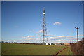
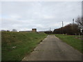
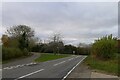
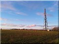

9 photos from this area
Area Information
Key information about the NG31 9TG including its size, population, and administrative classification.
- Area Type
- Postcode
- Area Size
- 2.5 hectares
- Population
- 2040
- Population Density
- 136 people/km²
House Prices in NG31 9TG
24
Properties
£108,363
Average Sold Price
£33,000
Lowest Price
£214,000
Highest Price
Showing 24 properties
| Address | Type | Beds | Baths | Last Sale Price | Last Sale Date | |
|---|---|---|---|---|---|---|
| 31 Fifth Avenue, Grantham, NG31 9TG | Semi-detached | 4 | 2 | £214,000 | Nov 2025 | |
| 59 Fifth Avenue, Grantham, NG31 9TG | Semi-detached | 3 | 1 | £189,950 | Nov 2024 | |
| 65 Fifth Avenue, Grantham, NG31 9TG | Semi-detached | 3 | - | £136,000 | Nov 2019 | |
| 55 Fifth Avenue, Grantham, NG31 9TG | house | 3 | - | £132,500 | Jun 2016 | |
| 43 Fifth Avenue, Grantham, NG31 9TG | Semi-detached | 3 | 2 | £125,000 | Oct 2015 | |
| 63 Fifth Avenue, Grantham, NG31 9TG | Semi-detached | - | - | £90,000 | Jul 2012 | |
| 37 Fifth Avenue, Grantham, NG31 9TG | house | 4 | - | £146,000 | Jun 2011 | |
| 51 Fifth Avenue, Grantham, NG31 9TG | house | 2 | - | £103,000 | Nov 2010 | |
| 49 Fifth Avenue, Grantham, NG31 9TG | house | - | - | £108,500 | Nov 2009 | |
| 73 Fifth Avenue, Grantham, NG31 9TG | Semi-detached | - | - | £93,000 | Sep 2005 |
Page 1 of 3
Energy Efficiency in NG31 9TG
Amenities
Schools
| Rank | School | Type | Entry gender | Ages |
|---|
Explore more schools in this area
Go to Schools tabDemographics
Household Size
Two person
most common
Accommodation Type
Houses
most common
Tenure
73
majority
Ethnic Group
White
most common
Religion
N/A
most common
Household Composition
N/A
most common
Age
47
median
Adults (30-64 years)
most common
Household Deprivation
N/A
with no deprivation
NS-SEC
33
in Lower managerial occupations
Explore more demographic insights in this area
Go to Demographics tabPlanning
Planning Constraints
- Flood RiskPremium
- Ramsar Wetland SitesPremium
- Area of Outstanding Natural BeautyPremium
- Protected Nature ReservePremium
- Protected WoodlandPremium