Area Overview for NG31 9FH
Photos of NG31 9FH
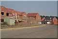
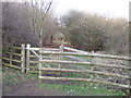
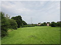
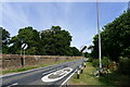
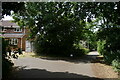
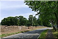
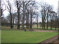
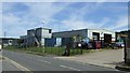
12 photos from this area
Area Information
Key information about the NG31 9FH including its size, population, and administrative classification.
- Area Type
- Postcode
- Area Size
- 7657 m²
- Population
- 2040
- Population Density
- 136 people/km²
House Prices in NG31 9FH
20
Properties
£209,000
Average Sold Price
£154,995
Lowest Price
£325,000
Highest Price
Showing 20 properties
| Address | Type | Beds | Baths | Last Sale Price | Last Sale Date | |
|---|---|---|---|---|---|---|
| 1 St Pierre Avenue, Grantham, NG31 9FH | Detached | 4 | 2 | £325,000 | Mar 2025 | |
| 19 St Pierre Avenue, Grantham, NG31 9FH | Detached | 3 | 2 | £257,000 | Mar 2023 | |
| 6 St Pierre Avenue, Grantham, NG31 9FH | Retail | 4 | 2 | £290,000 | Oct 2022 | |
| 10 St Pierre Avenue, Grantham, NG31 9FH | Detached | 4 | 2 | £269,950 | Jun 2021 | |
| 4 St Pierre Avenue, Grantham, NG31 9FH | Detached | 4 | 1 | £225,000 | Aug 2020 | |
| 12 St Pierre Avenue, Grantham, NG31 9FH | Detached | 4 | 2 | £249,999 | Nov 2018 | |
| 18 St Pierre Avenue, Grantham, NG31 9FH | Detached | 4 | - | £207,500 | May 2016 | |
| 16 St Pierre Avenue, Grantham, NG31 9FH | Detached | 4 | 2 | £172,000 | Nov 2014 | |
| 7 St Pierre Avenue, Grantham, NG31 9FH | Detached | 4 | - | £177,950 | Jun 2012 | |
| 17 St Pierre Avenue, Grantham, NG31 9FH | house | 4 | - | £168,500 | Aug 2010 |
Page 1 of 2
Energy Efficiency in NG31 9FH
Amenities
Schools
| Rank | School | Type | Entry gender | Ages |
|---|
Explore more schools in this area
Go to Schools tabDemographics
Household Size
Two person
most common
Accommodation Type
Houses
most common
Tenure
73
majority
Ethnic Group
White
most common
Religion
N/A
most common
Household Composition
N/A
most common
Age
47
median
Adults (30-64 years)
most common
Household Deprivation
N/A
with no deprivation
NS-SEC
33
in Lower managerial occupations
Explore more demographic insights in this area
Go to Demographics tabPlanning
Planning Constraints
- Flood RiskPremium
- Ramsar Wetland SitesPremium
- Area of Outstanding Natural BeautyPremium
- Protected Nature ReservePremium
- Protected WoodlandPremium