Area Overview for NG31 9BS
Photos of NG31 9BS
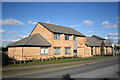
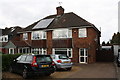
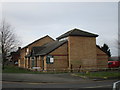

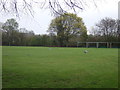
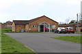

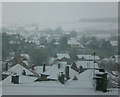

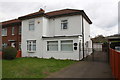
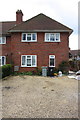
24 photos from this area
Area Information
Key information about the NG31 9BS including its size, population, and administrative classification.
- Area Type
- Postcode
- Area Size
- 3.0 hectares
- Population
- 1501
- Population Density
- 3012 people/km²
House Prices in NG31 9BS
52
Properties
£154,053
Average Sold Price
£42,500
Lowest Price
£415,000
Highest Price
Showing 52 properties
| Address | Type | Beds | Baths | Last Sale Price | Last Sale Date | |
|---|---|---|---|---|---|---|
| 3 Gorse Rise, Grantham, NG31 9BS | Semi-detached | 3 | 1 | £203,000 | Jul 2023 | |
| Ferndean, Gorse Rise, Grantham, NG31 9BS | Bungalow | 3 | 2 | £273,000 | Apr 2023 | |
| 12 Gorse Rise, Grantham, NG31 9BS | house | - | - | £168,000 | Dec 2022 | |
| 2 Gorse Rise, Grantham, NG31 9BS | Semi-detached | 3 | 1 | £200,000 | Aug 2022 | |
| 1 Gorse Rise, Grantham, NG31 9BS | house | - | - | £75,000 | Jul 2022 | |
| 25 Gorse Rise, Grantham, NG31 9BS | Semi-detached | 3 | 1 | £175,000 | May 2022 | |
| 31 Gorse Rise, Grantham, NG31 9BS | Semi-detached | 3 | 1 | £175,000 | Dec 2020 | |
| 19 Gorse Rise, Grantham, NG31 9BS | Semi-detached | 2 | 1 | £135,000 | Feb 2019 | |
| 18 Gorse Rise, Grantham, NG31 9BS | Semi-detached | 2 | 1 | £152,000 | Dec 2018 | |
| 5 Gorse Rise, Grantham, NG31 9BS | Semi-detached | 2 | 1 | £154,500 | Oct 2018 |
Page 1 of 6
Energy Efficiency in NG31 9BS
Amenities
Schools
| Rank | School | Type | Entry gender | Ages |
|---|
Explore more schools in this area
Go to Schools tabDemographics
Household Size
Two person
most common
Accommodation Type
Houses
most common
Tenure
75
majority
Ethnic Group
White
most common
Religion
N/A
most common
Household Composition
N/A
most common
Age
47
median
Adults (30-64 years)
most common
Household Deprivation
N/A
with no deprivation
NS-SEC
29
in Lower managerial occupations
Explore more demographic insights in this area
Go to Demographics tabPlanning
Planning Constraints
- Flood RiskPremium
- Ramsar Wetland SitesPremium
- Area of Outstanding Natural BeautyPremium
- Protected Nature ReservePremium
- Protected WoodlandPremium