Area Overview for NG31 9AG
Photos of NG31 9AG
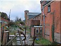
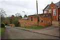
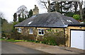
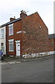
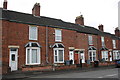
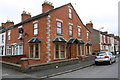
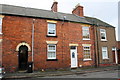
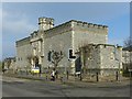
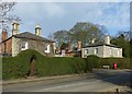
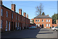
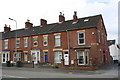

65 photos from this area
Area Information
Key information about the NG31 9AG including its size, population, and administrative classification.
- Area Type
- Postcode
- Area Size
- 4786 m²
- Population
- 1834
- Population Density
- 3953 people/km²
House Prices in NG31 9AG
29
Properties
£101,619
Average Sold Price
£17,950
Lowest Price
£185,000
Highest Price
Showing 29 properties
| Address | Type | Beds | Baths | Last Sale Price | Last Sale Date | |
|---|---|---|---|---|---|---|
| 24 St Annes Street, Grantham, NG31 9AG | Terraced | 2 | 1 | £116,000 | Jun 2024 | |
| 18 St Annes Street, Grantham, NG31 9AG | Terraced | 3 | 1 | £185,000 | May 2024 | |
| 21 St Annes Street, Grantham, NG31 9AG | Terraced | 3 | 2 | £160,000 | Jan 2023 | |
| 11 St Annes Street, Grantham, NG31 9AG | Retail | 3 | 1 | £175,000 | Oct 2022 | |
| 26 St Annes Street, Grantham, NG31 9AG | Terraced | 2 | 1 | £114,000 | Jun 2022 | |
| 17 St Annes Street, Grantham, NG31 9AG | Terraced | 2 | - | £181,000 | Jan 2022 | |
| 10 St Annes Street, Grantham, NG31 9AG | Terraced | 3 | - | £160,000 | Aug 2021 | |
| 22 St Annes Street, Grantham, NG31 9AG | Terraced | 3 | 2 | £131,000 | Nov 2017 | |
| 4 St Annes Street, Grantham, NG31 9AG | Terraced | 3 | - | £112,000 | Feb 2017 | |
| Culme Cottage, St Annes Street, Grantham, NG31 9AG | Terraced | - | - | £97,000 | Aug 2016 |
Page 1 of 3
Energy Efficiency in NG31 9AG
Amenities
Schools
| Rank | School | Type | Entry gender | Ages |
|---|
Explore more schools in this area
Go to Schools tabDemographics
Household Size
One person
most common
Accommodation Type
Houses
most common
Tenure
38
majority
Ethnic Group
White
most common
Religion
N/A
most common
Household Composition
N/A
most common
Age
47
median
Adults (30-64 years)
most common
Household Deprivation
N/A
with no deprivation
NS-SEC
24
in Lower managerial occupations
Explore more demographic insights in this area
Go to Demographics tabPlanning
Planning Constraints
- Flood RiskPremium
- Ramsar Wetland SitesPremium
- Area of Outstanding Natural BeautyPremium
- Protected Nature ReservePremium
- Protected WoodlandPremium