Area Overview for NG31 8HN
Photos of NG31 8HN
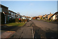
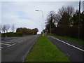
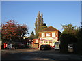
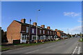
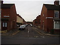
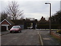
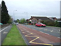
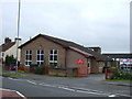
19 photos from this area
Area Information
Key information about the NG31 8HN including its size, population, and administrative classification.
- Area Type
- Postcode
- Area Size
- 3.1 hectares
- Population
- 2069
- Population Density
- 2245 people/km²
House Prices in NG31 8HN
44
Properties
£113,599
Average Sold Price
£37,700
Lowest Price
£240,000
Highest Price
Showing 44 properties
| Address | Type | Beds | Baths | Last Sale Price | Last Sale Date | |
|---|---|---|---|---|---|---|
| 2 Arnold Avenue, Grantham, NG31 8HN | Detached | 3 | 1 | £240,000 | Dec 2023 | |
| 19 Arnold Avenue, Grantham, NG31 8HN | Semi-detached | 3 | 1 | £190,000 | Apr 2023 | |
| 9 Arnold Avenue, Grantham, NG31 8HN | Semi-detached | 3 | 2 | £177,000 | Mar 2022 | |
| 51 Arnold Avenue, Grantham, NG31 8HN | house | - | - | £180,000 | Aug 2021 | |
| 27 Arnold Avenue, Grantham, NG31 8HN | Semi-detached | 3 | 1 | £152,500 | Apr 2021 | |
| 16 Arnold Avenue, Grantham, NG31 8HN | Semi-detached | 3 | 2 | £123,000 | Oct 2018 | |
| 13 Arnold Avenue, Grantham, NG31 8HN | Semi-detached | 3 | 1 | £150,000 | May 2018 | |
| 14 Arnold Avenue, Grantham, NG31 8HN | Semi-detached | 3 | 1 | £107,408 | Jun 2017 | |
| 3 Arnold Avenue, Grantham, NG31 8HN | Detached | 3 | - | £137,000 | Jun 2015 | |
| 26 Arnold Avenue, Grantham, NG31 8HN | house | 3 | 1 | £134,500 | Sep 2014 |
Page 1 of 5
Energy Efficiency in NG31 8HN
Amenities
Schools
| Rank | School | Type | Entry gender | Ages |
|---|
Explore more schools in this area
Go to Schools tabDemographics
Household Size
Two person
most common
Accommodation Type
Houses
most common
Tenure
84
majority
Ethnic Group
White
most common
Religion
N/A
most common
Household Composition
N/A
most common
Age
47
median
Adults (30-64 years)
most common
Household Deprivation
N/A
with no deprivation
NS-SEC
32
in Lower managerial occupations
Explore more demographic insights in this area
Go to Demographics tabPlanning
Planning Constraints
- Flood RiskPremium
- Ramsar Wetland SitesPremium
- Area of Outstanding Natural BeautyPremium
- Protected Nature ReservePremium
- Protected WoodlandPremium