Area Overview for NG31 8BQ
Photos of NG31 8BQ
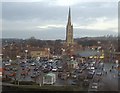
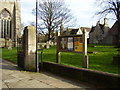
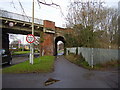
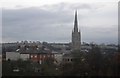
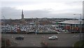
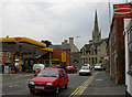
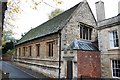
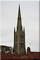
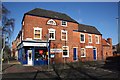
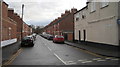
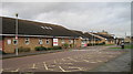
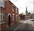
100 photos from this area
Area Information
Key information about the NG31 8BQ including its size, population, and administrative classification.
- Area Type
- Postcode
- Area Size
- 2628 m²
- Population
- 1566
- Population Density
- 3214 people/km²
House Prices in NG31 8BQ
19
Properties
£141,268
Average Sold Price
£56,000
Lowest Price
£205,000
Highest Price
Showing 19 properties
| Address | Type | Beds | Baths | Last Sale Price | Last Sale Date | |
|---|---|---|---|---|---|---|
| 12 Albion Place, Grantham, NG31 8BQ | Terraced | 3 | 1 | £205,000 | Jan 2025 | |
| 10 Albion Place, Grantham, NG31 8BQ | Detached | 3 | 1 | £135,000 | Jun 2023 | |
| 9 Albion Place, Grantham, NG31 8BQ | Detached | 3 | 1 | £160,000 | Aug 2021 | |
| 2 Albion Place, Grantham, NG31 8BQ | Terraced | 3 | 2 | £120,000 | Apr 2021 | |
| 11 Albion Place, Grantham, NG31 8BQ | Terraced | 4 | 2 | £166,500 | Apr 2020 | |
| 4 Albion Place, Grantham, NG31 8BQ | house | - | - | £141,000 | May 2018 | |
| 12A Albion Place, Grantham, NG31 8BQ | Terraced | 3 | 1 | £168,000 | Mar 2018 | |
| 7 Albion Place, Grantham, NG31 8BQ | house | - | - | £125,000 | Dec 2016 | |
| 1 Albion Place, Grantham, NG31 8BQ | house | - | - | £185,000 | Mar 2006 | |
| 3 Albion Place, Grantham, NG31 8BQ | Terraced | 3 | 1 | £92,450 | Apr 2003 |
Page 1 of 2
Energy Efficiency in NG31 8BQ
Amenities
Schools
| Rank | School | Type | Entry gender | Ages |
|---|
Explore more schools in this area
Go to Schools tabDemographics
Household Size
One person
most common
Accommodation Type
Houses
most common
Tenure
41
majority
Ethnic Group
White
most common
Religion
N/A
most common
Household Composition
N/A
most common
Age
47
median
Adults (30-64 years)
most common
Household Deprivation
N/A
with no deprivation
NS-SEC
27
in Lower managerial occupations
Explore more demographic insights in this area
Go to Demographics tabPlanning
Planning Constraints
- Flood RiskPremium
- Ramsar Wetland SitesPremium
- Area of Outstanding Natural BeautyPremium
- Protected Nature ReservePremium
- Protected WoodlandPremium