Area Overview for NG31 7AX
Photos of NG31 7AX


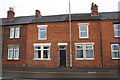
49 photos from this area
Area Information
Key information about the NG31 7AX including its size, population, and administrative classification.
- Area Type
- Postcode
- Area Size
- 7195 m²
- Population
- 2318
- Population Density
- 3004 people/km²
House Prices in NG31 7AX
26
Properties
£126,115
Average Sold Price
£34,000
Lowest Price
£202,000
Highest Price
Showing 26 properties
| Address | Type | Beds | Baths | Last Sale Price | Last Sale Date | |
|---|---|---|---|---|---|---|
| 158 Huntingtower Road, Grantham, NG31 7AX | Semi-detached | 3 | 1 | £202,000 | Jul 2025 | |
| 140 Huntingtower Road, Grantham, NG31 7AX | house | 3 | - | £192,500 | May 2025 | |
| 120 Huntingtower Road, Grantham, NG31 7AX | house | - | - | £140,000 | Nov 2021 | |
| 128 Huntingtower Road, Grantham, NG31 7AX | house | - | - | £172,500 | Aug 2021 | |
| 112 Huntingtower Road, Grantham, NG31 7AX | Semi-detached | 3 | 1 | £155,000 | Jun 2021 | |
| 152 Huntingtower Road, Grantham, NG31 7AX | Semi-detached | 3 | 1 | £142,000 | Mar 2019 | |
| 110 Huntingtower Road, Grantham, NG31 7AX | house | - | - | £161,000 | Aug 2017 | |
| 122 Huntingtower Road, Grantham, NG31 7AX | Semi-detached | 3 | 1 | £149,950 | Jun 2016 | |
| 116 Huntingtower Road, Grantham, NG31 7AX | Semi-detached | 3 | 1 | £135,000 | Feb 2015 | |
| 148 Huntingtower Road, Grantham, NG31 7AX | Semi-detached | 3 | 1 | £105,000 | Nov 2012 |
Page 1 of 3
Energy Efficiency in NG31 7AX
Amenities
Schools
| Rank | School | Type | Entry gender | Ages |
|---|
Explore more schools in this area
Go to Schools tabDemographics
Household Size
One person
most common
Accommodation Type
Houses
most common
Tenure
39
majority
Ethnic Group
White
most common
Religion
N/A
most common
Household Composition
N/A
most common
Age
47
median
Adults (30-64 years)
most common
Household Deprivation
N/A
with no deprivation
NS-SEC
24
in Lower managerial occupations
Explore more demographic insights in this area
Go to Demographics tabPlanning
Planning Constraints
- Flood RiskPremium
- Ramsar Wetland SitesPremium
- Area of Outstanding Natural BeautyPremium
- Protected Nature ReservePremium
- Protected WoodlandPremium