Area Overview for NG3 7GH
Photos of NG3 7GH
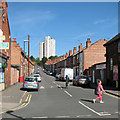
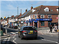
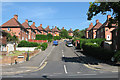
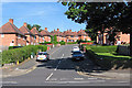
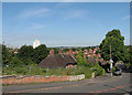
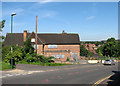
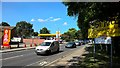

59 photos from this area
Area Information
Key information about the NG3 7GH including its size, population, and administrative classification.
- Area Type
- Postcode
- Area Size
- 1.8 hectares
- Population
- 1686
- Population Density
- 6257 people/km²
House Prices in NG3 7GH
37
Properties
£168,784
Average Sold Price
£39,500
Lowest Price
£320,000
Highest Price
Showing 37 properties
| Address | Type | Beds | Baths | Last Sale Price | Last Sale Date | |
|---|---|---|---|---|---|---|
| 88 Bakerdale Road, Nottingham, NG3 7GH | Bungalow | 3 | 1 | £257,000 | Sep 2025 | |
| 32 Bakerdale Road, Nottingham, NG3 7GH | Semi-detached | 3 | 1 | £265,000 | May 2025 | |
| 48 Bakerdale Road, Nottingham, NG3 7GH | Semi-detached | 3 | 1 | £278,500 | May 2025 | |
| 100 Bakerdale Road, Nottingham, NG3 7GH | Detached | 3 | 1 | £320,000 | Mar 2023 | |
| 30 Bakerdale Road, Nottingham, NG3 7GH | Retail | 3 | 1 | £300,000 | Nov 2022 | |
| 40 Bakerdale Road, Nottingham, NG3 7GH | Semi-detached | 3 | 1 | £234,000 | Oct 2022 | |
| 28 Bakerdale Road, Nottingham, NG3 7GH | Retail | 3 | 1 | £200,000 | Apr 2022 | |
| 26 Bakerdale Road, Nottingham, NG3 7GH | house | - | - | £187,500 | Sep 2021 | |
| 14 Bakerdale Road, Nottingham, NG3 7GH | Detached | 5 | 1 | £250,000 | Oct 2018 | |
| 90 Bakerdale Road, Nottingham, NG3 7GH | house | 3 | - | £205,000 | Feb 2018 |
Page 1 of 4
Energy Efficiency in NG3 7GH
Amenities
Schools
| Rank | School | Type | Entry gender | Ages |
|---|
Explore more schools in this area
Go to Schools tabDemographics
Household Size
Family (3-5 people)
most common
Accommodation Type
Houses
most common
Tenure
84
majority
Ethnic Group
White
most common
Religion
N/A
most common
Household Composition
N/A
most common
Age
47
median
Adults (30-64 years)
most common
Household Deprivation
N/A
with no deprivation
NS-SEC
26
in Lower managerial occupations
Explore more demographic insights in this area
Go to Demographics tabPlanning
Planning Constraints
- Flood RiskPremium
- Ramsar Wetland SitesPremium
- Area of Outstanding Natural BeautyPremium
- Protected Nature ReservePremium
- Protected WoodlandPremium