Area Overview for NG3 7FY
Photos of NG3 7FY
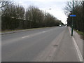
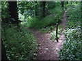
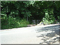
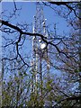
88 photos from this area
Area Information
Key information about the NG3 7FY including its size, population, and administrative classification.
- Area Type
- Postcode
- Area Size
- 37.7 hectares
- Population
- 1942
- Population Density
- 2304 people/km²
House Prices in NG3 7FY
58
Properties
£140,674
Average Sold Price
£39,000
Lowest Price
£285,000
Highest Price
Showing 58 properties
| Address | Type | Beds | Baths | Last Sale Price | Last Sale Date | |
|---|---|---|---|---|---|---|
| 196 Greenwood Road, Nottingham, NG3 7FY | Semi-detached | 3 | 1 | £246,000 | Jul 2024 | |
| 202 Greenwood Road, Nottingham, NG3 7FY | house | - | - | £197,000 | Jul 2024 | |
| 248 Greenwood Road, Nottingham, NG3 7FY | Bungalow | 3 | 1 | £285,000 | Apr 2024 | |
| 204 Greenwood Road, Nottingham, NG3 7FY | house | 3 | - | £197,500 | Dec 2021 | |
| 246 Greenwood Road, Nottingham, NG3 7FY | Detached | 3 | 1 | £250,000 | Nov 2021 | |
| 218 Greenwood Road, Nottingham, NG3 7FY | Semi-detached | 3 | 1 | £173,000 | Jun 2021 | |
| 232 Greenwood Road, Nottingham, NG3 7FY | Detached | 4 | 2 | £254,000 | Sep 2019 | |
| 200 Greenwood Road, Nottingham, NG3 7FY | Semi-detached | 3 | 1 | £151,000 | May 2019 | |
| 256 Greenwood Road, Nottingham, NG3 7FY | Bungalow | 2 | - | £171,000 | Apr 2019 | |
| 242 Greenwood Road, Nottingham, NG3 7FY | Bungalow | 3 | 1 | £157,500 | Feb 2019 |
Page 1 of 6
Energy Efficiency in NG3 7FY
Amenities
Schools
| Rank | School | Type | Entry gender | Ages |
|---|
Explore more schools in this area
Go to Schools tabDemographics
Household Size
One person
most common
Accommodation Type
Houses
most common
Tenure
54
majority
Ethnic Group
White
most common
Religion
N/A
most common
Household Composition
N/A
most common
Age
47
median
Adults (30-64 years)
most common
Household Deprivation
N/A
with no deprivation
NS-SEC
18
in Lower managerial occupations
Explore more demographic insights in this area
Go to Demographics tabPlanning
Planning Constraints
- Flood RiskPremium
- Ramsar Wetland SitesPremium
- Area of Outstanding Natural BeautyPremium
- Protected Nature ReservePremium
- Protected WoodlandPremium