Area Overview for NG3 6DW
Photos of NG3 6DW
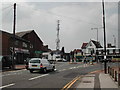
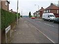

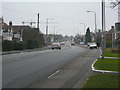
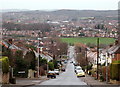
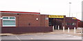
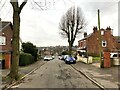
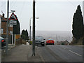
34 photos from this area
Area Information
Key information about the NG3 6DW including its size, population, and administrative classification.
- Area Type
- Postcode
- Area Size
- 5011 m²
- Population
- 1367
- Population Density
- 4456 people/km²
House Prices in NG3 6DW
14
Properties
£204,692
Average Sold Price
£67,900
Lowest Price
£385,000
Highest Price
Showing 14 properties
| Address | Type | Beds | Baths | Last Sale Price | Last Sale Date | |
|---|---|---|---|---|---|---|
| 2 Lambley Avenue, Mapperley, NG3 6DW | Detached | 3 | 1 | £385,000 | Jan 2025 | |
| 7 Lambley Avenue, Mapperley, NG3 6DW | Detached | 3 | 1 | £325,000 | Mar 2023 | |
| 12 Lambley Avenue, Mapperley, NG3 6DW | house | - | - | £250,000 | Sep 2017 | |
| 11 Lambley Avenue, Mapperley, NG3 6DW | Detached | 3 | 1 | £265,000 | Aug 2016 | |
| 8 Lambley Avenue, Mapperley, NG3 6DW | house | 3 | 1 | £195,000 | Feb 2016 | |
| 10 Lambley Avenue, Mapperley, NG3 6DW | house | - | - | £188,000 | Aug 2010 | |
| 1 Lambley Avenue, Mapperley, NG3 6DW | house | - | - | £189,950 | Apr 2010 | |
| 4 Lambley Avenue, Mapperley, NG3 6DW | Detached | - | - | £185,000 | May 2007 | |
| 6 Lambley Avenue, Mapperley, NG3 6DW | Detached | - | - | £184,500 | Oct 2003 | |
| 5 Lambley Avenue, Mapperley, NG3 6DW | Detached | - | - | £114,950 | Sep 2002 |
Page 1 of 2
Energy Efficiency in NG3 6DW
Amenities
Schools
| Rank | School | Type | Entry gender | Ages |
|---|
Explore more schools in this area
Go to Schools tabDemographics
Household Size
Two person
most common
Accommodation Type
Houses
most common
Tenure
86
majority
Ethnic Group
White
most common
Religion
N/A
most common
Household Composition
N/A
most common
Age
47
median
Adults (30-64 years)
most common
Household Deprivation
N/A
with no deprivation
NS-SEC
42
in Lower managerial occupations
Explore more demographic insights in this area
Go to Demographics tabPlanning
Planning Constraints
- Flood RiskPremium
- Ramsar Wetland SitesPremium
- Area of Outstanding Natural BeautyPremium
- Protected Nature ReservePremium
- Protected WoodlandPremium