Area Overview for NG3 6DN
Photos of NG3 6DN
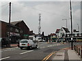
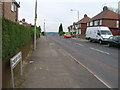
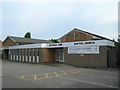
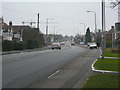
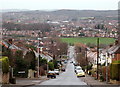
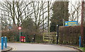
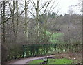
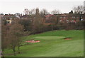
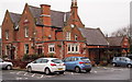
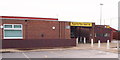
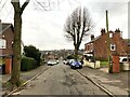
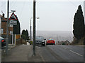
34 photos from this area
Area Information
Key information about the NG3 6DN including its size, population, and administrative classification.
- Area Type
- Postcode
- Area Size
- 1.9 hectares
- Population
- 1514
- Population Density
- 1632 people/km²
House Prices in NG3 6DN
40
Properties
£247,738
Average Sold Price
£50,000
Lowest Price
£570,000
Highest Price
Showing 40 properties
| Address | Type | Beds | Baths | Last Sale Price | Last Sale Date | |
|---|---|---|---|---|---|---|
| 32 Hazel Grove, Mapperley, NG3 6DN | Semi-detached | 3 | 1 | £355,000 | Feb 2024 | |
| 12 Hazel Grove, Mapperley, NG3 6DN | Semi-detached | 3 | 1 | £300,000 | Nov 2022 | |
| 74 Hazel Grove, Mapperley, NG3 6DN | Retail | 4 | 1 | £550,000 | Sep 2022 | |
| 60 Hazel Grove, Mapperley, NG3 6DN | house | - | - | £570,000 | Aug 2022 | |
| 52 Hazel Grove, Mapperley, NG3 6DN | Semi-detached | 4 | 2 | £355,000 | Mar 2021 | |
| 2 Hazel Grove, Mapperley, NG3 6DN | house | - | - | £371,000 | Feb 2021 | |
| 64 Hazel Grove, Mapperley, NG3 6DN | Detached | 4 | 2 | £480,000 | Jan 2021 | |
| 22 Hazel Grove, Mapperley, NG3 6DN | Semi-detached | 3 | 1 | £250,000 | Nov 2019 | |
| 56 Hazel Grove, Mapperley, NG3 6DN | Semi-detached | 3 | 1 | £227,000 | Oct 2019 | |
| 16 Hazel Grove, Mapperley, NG3 6DN | Semi-detached | 3 | 1 | £260,000 | Jul 2019 |
Page 1 of 4
Energy Efficiency in NG3 6DN
Amenities
Schools
| Rank | School | Type | Entry gender | Ages |
|---|
Explore more schools in this area
Go to Schools tabDemographics
Household Size
One person
most common
Accommodation Type
Houses
most common
Tenure
70
majority
Ethnic Group
White
most common
Religion
N/A
most common
Household Composition
N/A
most common
Age
47
median
Adults (30-64 years)
most common
Household Deprivation
N/A
with no deprivation
NS-SEC
43
in Lower managerial occupations
Explore more demographic insights in this area
Go to Demographics tabPlanning
Planning Constraints
- Flood RiskPremium
- Ramsar Wetland SitesPremium
- Area of Outstanding Natural BeautyPremium
- Protected Nature ReservePremium
- Protected WoodlandPremium