Area Overview for NG3 5UT
Photos of NG3 5UT

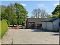
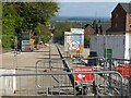
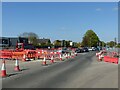
29 photos from this area
Area Information
Key information about the NG3 5UT including its size, population, and administrative classification.
- Area Type
- Postcode
- Area Size
- 4571 m²
- Population
- 1514
- Population Density
- 1632 people/km²
House Prices in NG3 5UT
28
Properties
£167,285
Average Sold Price
£91,000
Lowest Price
£315,000
Highest Price
Showing 28 properties
| Address | Type | Beds | Baths | Last Sale Price | Last Sale Date | |
|---|---|---|---|---|---|---|
| 29 Swindell Close, Mapperley, NG3 5UT | Flat | 2 | 1 | £129,000 | May 2025 | |
| 3 Swindell Close, Mapperley, NG3 5UT | Flat | - | - | £160,000 | Feb 2025 | |
| 8 Swindell Close, Mapperley, NG3 5UT | Detached | 3 | 2 | £275,000 | Jun 2024 | |
| 1 Swindell Close, Mapperley, NG3 5UT | Flat | 2 | 2 | £155,000 | Jan 2024 | |
| 37 Swindell Close, Mapperley, NG3 5UT | Flat | - | - | £150,000 | Jan 2023 | |
| 7 Swindell Close, Mapperley, NG3 5UT | Flat | - | - | £150,000 | Sep 2021 | |
| 4 Swindell Close, Mapperley, NG3 5UT | Detached | 4 | 2 | £315,000 | Dec 2020 | |
| 23 Swindell Close, Mapperley, NG3 5UT | Flat | 2 | 1 | £150,000 | Jun 2020 | |
| 17 Swindell Close, Mapperley, NG3 5UT | Terraced | 2 | - | £150,000 | Apr 2017 | |
| 5 Swindell Close, Mapperley, NG3 5UT | Flat | - | - | £130,000 | Aug 2016 |
Page 1 of 3
Energy Efficiency in NG3 5UT
Amenities
Schools
| Rank | School | Type | Entry gender | Ages |
|---|
Explore more schools in this area
Go to Schools tabDemographics
Household Size
One person
most common
Accommodation Type
Houses
most common
Tenure
70
majority
Ethnic Group
White
most common
Religion
N/A
most common
Household Composition
N/A
most common
Age
47
median
Adults (30-64 years)
most common
Household Deprivation
N/A
with no deprivation
NS-SEC
43
in Lower managerial occupations
Explore more demographic insights in this area
Go to Demographics tabPlanning
Planning Constraints
- Flood RiskPremium
- Ramsar Wetland SitesPremium
- Area of Outstanding Natural BeautyPremium
- Protected Nature ReservePremium
- Protected WoodlandPremium