Area Overview for NG3 3NW
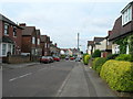
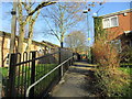
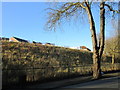
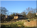
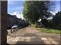
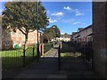
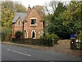
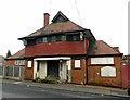
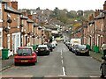
Photos of NG3 3NW


Area Information
Living in NG3 3NW means residing within a specific postcode area that covers a small residential cluster of approximately 2,209 people. This location sits squarely in Nottinghamshire, offering a compact living environment where residents know each other by name. The area is defined by its residential focus rather than commercial or industrial use, providing a quiet backdrop for daily life. You will find that this cluster represents a microcosm of the wider neighbourhood, balancing the needs of families and professionals who require a stable, non-touristy environment. The population size suggests a community where local shops and services are more likely to cater to long-term residents rather than transient visitors. Life here revolves around the stability of established households and the convenience of having essential services within practical reach. While the area lacks the grandeur of larger urban centres, its defined boundaries create a sense of locality that appeals to those seeking a grounded lifestyle. The small population figure indicates that noise pollution and overcrowding are minimal concerns. You are part of a tight-knit group where community events and local interactions hold significant weight. The demographic makeup reflects a mature age profile, suggesting that this is a place for established individuals rather than transient commuters.
- Area Type
- Postcode
- Area Size
- Not available
- Population
- 2209
- Population Density
- 8829 people/km²
House Prices in NG3 3NW
No properties found in this postcode.
Energy Efficiency in NG3 3NW
Amenities
Schools
| Rank | School | Type | Entry gender | Ages |
|---|
Explore more schools in this area
Go to Schools tabDemographics
The community in NG3 3NW reflects a mature population with a median age of 47 years. This age profile indicates that the area is dominated by adults between 30 and 64 years old, suggesting a household structure focused on married couples, families with children, or empty-nesters rather than single students or young professionals under 30. The small population of 2,209 reinforces the idea of an established community where generational ties often influence local dynamics. Home ownership stands at 30% within this postcode. This figure means that while a significant portion of residents own their homes, there remains a substantial rental sector. The presence of both owners and renters contributes to a stable yet fluid housing market. Accommodation types in this specific cluster are primarily houses, which aligns with the demographic preference for space and stability found in this age bracket. The predominant ethnic group is White, reflecting the broader ethnic composition of the region. This demographic data paints a picture of a traditional residential area where the residents likely value stability and family-oriented living arrangements over the high-density urban_opts often found in city centres.
Household Size
Accommodation Type
Tenure
Ethnic Group
Religion
Household Composition
Age
Household Deprivation
NS-SEC
Explore more demographic insights in this area
Go to Demographics tabPlanning
Planning Constraints
- Flood RiskPremium
- Ramsar Wetland SitesPremium
- Area of Outstanding Natural BeautyPremium
- Protected Nature ReservePremium
- Protected WoodlandPremium