Area Overview for NG25 0UT
Photos of NG25 0UT
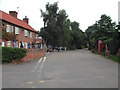
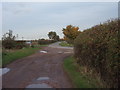
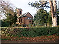
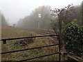
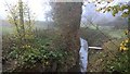
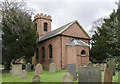
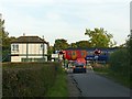
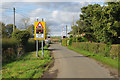
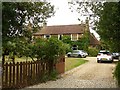

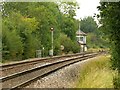
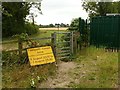
86 photos from this area
Area Information
Key information about the NG25 0UT including its size, population, and administrative classification.
- Area Type
- Postcode
- Area Size
- 16.3 hectares
- Population
- 1145
- Population Density
- 87 people/km²
House Prices in NG25 0UT
33
Properties
£409,385
Average Sold Price
£101,000
Lowest Price
£760,000
Highest Price
Showing 33 properties
| Address | Type | Beds | Baths | Last Sale Price | Last Sale Date | |
|---|---|---|---|---|---|---|
| Chalfont, Main Street, Morton, NG25 0UT | Detached | 4 | 2 | £605,000 | Oct 2023 | |
| Bramley Peacock, Main Street, Morton, NG25 0UT | house | 4 | 2 | £635,000 | Feb 2019 | |
| Jacaranda Barn, Main Street, Morton, NG25 0UT | Semi-detached | - | - | £175,000 | Jan 2019 | |
| Longacre, Main Street, Morton, NG25 0UT | house | 4 | 2 | £506,000 | Apr 2016 | |
| Oakdene, Main Street, Morton, NG25 0UT | house | - | - | £760,000 | Jul 2015 | |
| Fir Tree House, Main Street, Morton, NG25 0UT | Detached | 4 | 3 | £526,000 | Aug 2014 | |
| White Cottage, Main Street, Morton, NG25 0UT | Detached | 4 | - | £380,000 | Aug 2014 | |
| Maple House, Main Street, Morton, NG25 0UT | Bungalow | 3 | - | £585,000 | Aug 2010 | |
| Ivy Cottage, Main Street, Morton, NG25 0UT | Detached | - | - | £435,000 | Jun 2004 | |
| Clumber Farm, Main Street, Morton, NG25 0UT | Detached | - | - | £175,000 | Dec 2000 |
Page 1 of 4
Energy Efficiency in NG25 0UT
Amenities
Schools
| Rank | School | Type | Entry gender | Ages |
|---|
Explore more schools in this area
Go to Schools tabDemographics
Household Size
Two person
most common
Accommodation Type
Houses
most common
Tenure
91
majority
Ethnic Group
White
most common
Religion
N/A
most common
Household Composition
N/A
most common
Age
47
median
Adults (30-64 years)
most common
Household Deprivation
N/A
with no deprivation
NS-SEC
53
in Lower managerial occupations
Explore more demographic insights in this area
Go to Demographics tabPlanning
Planning Constraints
- Flood RiskPremium
- Ramsar Wetland SitesPremium
- Area of Outstanding Natural BeautyPremium
- Protected Nature ReservePremium
- Protected WoodlandPremium