Area Overview for NG25 0EE
Photos of NG25 0EE
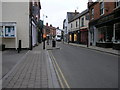
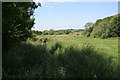
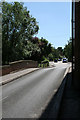
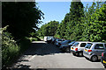
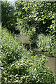
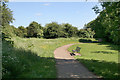
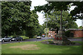
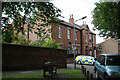
100 photos from this area
Area Information
Key information about the NG25 0EE including its size, population, and administrative classification.
- Area Type
- Postcode
- Area Size
- 1.6 hectares
- Population
- 2196
- Population Density
- 234 people/km²
House Prices in NG25 0EE
18
Properties
£245,042
Average Sold Price
£114,000
Lowest Price
£490,000
Highest Price
Showing 18 properties
| Address | Type | Beds | Baths | Last Sale Price | Last Sale Date | |
|---|---|---|---|---|---|---|
| 16 Greet Park Close, Southwell, NG25 0EE | Detached | 4 | 2 | £490,000 | Jun 2021 | |
| 3 Greet Park Close, Southwell, NG25 0EE | house | - | - | £415,000 | Mar 2020 | |
| 8 Greet Park Close, Southwell, NG25 0EE | Detached | - | - | £200,000 | Nov 2018 | |
| 2 Greet Park Close, Southwell, NG25 0EE | Detached | 4 | - | £317,000 | Jul 2013 | |
| 5 Greet Park Close, Southwell, NG25 0EE | house | - | - | £336,000 | May 2011 | |
| 17 Greet Park Close, Southwell, NG25 0EE | Detached | - | - | £322,000 | Jul 2005 | |
| 19 Greet Park Close, Southwell, NG25 0EE | Detached | - | - | £218,000 | Apr 2003 | |
| 9 Greet Park Close, Southwell, NG25 0EE | Detached | - | - | £132,500 | Dec 1999 | |
| 14 Greet Park Close, Southwell, NG25 0EE | Detached | - | - | £140,000 | Dec 1999 | |
| 11 Greet Park Close, Southwell, NG25 0EE | Detached | 5 | 3 | £135,005 | Feb 1999 |
Page 1 of 2
Energy Efficiency in NG25 0EE
Amenities
Schools
| Rank | School | Type | Entry gender | Ages |
|---|
Explore more schools in this area
Go to Schools tabDemographics
Household Size
Two person
most common
Accommodation Type
Houses
most common
Tenure
71
majority
Ethnic Group
White
most common
Religion
N/A
most common
Household Composition
N/A
most common
Age
47
median
Adults (30-64 years)
most common
Household Deprivation
N/A
with no deprivation
NS-SEC
47
in Lower managerial occupations
Explore more demographic insights in this area
Go to Demographics tabPlanning
Planning Constraints
- Flood RiskPremium
- Ramsar Wetland SitesPremium
- Area of Outstanding Natural BeautyPremium
- Protected Nature ReservePremium
- Protected WoodlandPremium