Area Overview for NG25 0DX
Photos of NG25 0DX

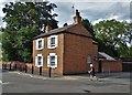
50 photos from this area
Area Information
Key information about the NG25 0DX including its size, population, and administrative classification.
- Area Type
- Postcode
- Area Size
- 1.4 hectares
- Population
- 2135
- Population Density
- 2082 people/km²
House Prices in NG25 0DX
9
Properties
£476,500
Average Sold Price
£375,000
Lowest Price
£660,000
Highest Price
Showing 9 properties
| Address | Type | Beds | Baths | Last Sale Price | Last Sale Date | |
|---|---|---|---|---|---|---|
| 122 Lower Kirklington Road, Southwell, NG25 0DX | Detached | 3 | 2 | £482,500 | Jan 2021 | |
| Pear Tree Cottage, Lower Kirklington Road, Southwell, NG25 0DX | Detached | 4 | 2 | £660,000 | May 2018 | |
| The Quadrant, 118A Lower Kirklington Road, Southwell, NG25 0DX | house | - | - | £375,000 | Feb 2017 | |
| The Ridge, 116 Lower Kirklington Road, Southwell, NG25 0DX | house | - | - | £450,000 | Jul 2010 | |
| Redroof, Lower Kirklington Road, Southwell, NG25 0DX | Detached | 4 | 1 | £415,000 | Aug 2005 | |
| Rose Villa, 118 Lower Kirklington Road, Southwell, NG25 0DX | Detached | 4 | 1 | - | - | |
| High Gables, Lower Kirklington Road, Southwell, NG25 0DX | Bungalow | 5 | - | - | - | |
| 120 Lower Kirklington Road, Southwell, NG25 0DX | Detached | - | - | - | - | |
| The Beacon, Lower Kirklington Road, Southwell, NG25 0DX | house | - | - | - | - |
Energy Efficiency in NG25 0DX
Amenities
Schools
| Rank | School | Type | Entry gender | Ages |
|---|
Explore more schools in this area
Go to Schools tabDemographics
Household Size
Two person
most common
Accommodation Type
Houses
most common
Tenure
81
majority
Ethnic Group
White
most common
Religion
N/A
most common
Household Composition
N/A
most common
Age
47
median
Adults (30-64 years)
most common
Household Deprivation
N/A
with no deprivation
NS-SEC
40
in Lower managerial occupations
Explore more demographic insights in this area
Go to Demographics tabPlanning
Planning Constraints
- Flood RiskPremium
- Ramsar Wetland SitesPremium
- Area of Outstanding Natural BeautyPremium
- Protected Nature ReservePremium
- Protected WoodlandPremium