Area Overview for NG24 3SD
Photos of NG24 3SD

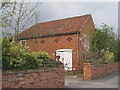
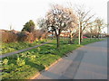
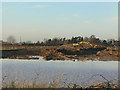
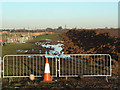
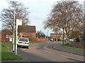
23 photos from this area
Area Information
Key information about the NG24 3SD including its size, population, and administrative classification.
- Area Type
- Postcode
- Area Size
- 50.6 hectares
- Population
- 1451
- Population Density
- 94 people/km²
House Prices in NG24 3SD
15
Properties
-
Average Sold Price
-
Lowest Price
-
Highest Price
Showing 15 properties
| Address | Type | Beds | Baths | Last Sale Price | Last Sale Date | |
|---|---|---|---|---|---|---|
| Static Caravan 1, Corner House Farm, Hawton Lane, Farndon, NG24 3SD | Mobile Home | - | - | - | - | |
| Static Caravan 2, Corner House Farm, Hawton Lane, Farndon, NG24 3SD | Industrial | - | - | - | - | |
| Unit 21, Hardys Business Park, Hawton Lane, Farndon, NG24 3SD | office_workshop | - | - | - | - | |
| Keld Ampworks, Unit 22, Hardys Business Park, Hawton Lane, Farndon, NG24 3SD | office_workshop | - | - | - | - | |
| Unit 23, Hardys Business Park, Hawton Lane, Farndon, NG24 3SD | Industrial | - | - | - | - | |
| Unit 24, Hardys Business Park, Hawton Lane, Farndon, NG24 3SD | Industrial | - | - | - | - | |
| East Midlands Catering Solutions, Hardys Farm Shop, Hawton Lane, Farndon, NG24 3SD | Restaurant | - | - | - | - | |
| Lizzie Kay Design, Hardys Farm Shop, Corner House Farm, Hawton Lane, Farndon, NG24 3SD | retail_financial | - | - | - | - | |
| Farm Cottage, Hawton Lane, Farndon, NG24 3SD | Detached | - | - | - | - | |
| Eastgate, Hawton Lane, Farndon, NG24 3SD | Detached | - | - | - | - |
Page 1 of 2
Energy Efficiency in NG24 3SD
Amenities
Schools
| Rank | School | Type | Entry gender | Ages |
|---|
Explore more schools in this area
Go to Schools tabDemographics
Household Size
Two person
most common
Accommodation Type
Houses
most common
Tenure
85
majority
Ethnic Group
White
most common
Religion
N/A
most common
Household Composition
N/A
most common
Age
47
median
Adults (30-64 years)
most common
Household Deprivation
N/A
with no deprivation
NS-SEC
36
in Lower managerial occupations
Explore more demographic insights in this area
Go to Demographics tabPlanning
Planning Constraints
- Flood RiskPremium
- Ramsar Wetland SitesPremium
- Area of Outstanding Natural BeautyPremium
- Protected Nature ReservePremium
- Protected WoodlandPremium