Area Overview for NG24 3QE
Photos of NG24 3QE
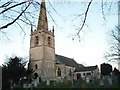
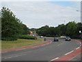
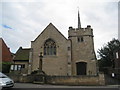
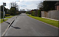
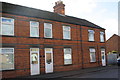
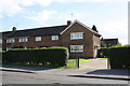
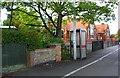
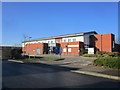
61 photos from this area
Area Information
Key information about the NG24 3QE including its size, population, and administrative classification.
- Area Type
- Postcode
- Area Size
- 2.3 hectares
- Population
- 1508
- Population Density
- 4021 people/km²
House Prices in NG24 3QE
44
Properties
£150,275
Average Sold Price
£57,000
Lowest Price
£273,000
Highest Price
Showing 44 properties
| Address | Type | Beds | Baths | Last Sale Price | Last Sale Date | |
|---|---|---|---|---|---|---|
| 72 Warwick Road, Balderton, NG24 3QE | Bungalow | 3 | 1 | £273,000 | Oct 2023 | |
| 38 Warwick Road, Balderton, NG24 3QE | Semi-detached | 3 | 1 | £178,000 | Aug 2023 | |
| 40 Warwick Road, Balderton, NG24 3QE | Terraced | 3 | 1 | £235,000 | Jun 2023 | |
| 36 Warwick Road, Balderton, NG24 3QE | Semi-detached | 3 | 1 | £182,500 | Apr 2023 | |
| 19 Warwick Road, Balderton, NG24 3QE | Semi-detached | 3 | 1 | £198,000 | Apr 2022 | |
| 70 Warwick Road, Balderton, NG24 3QE | Bungalow | 3 | 1 | £250,000 | Sep 2021 | |
| 34 Warwick Road, Balderton, NG24 3QE | house | - | - | £180,000 | Jun 2021 | |
| 22 Warwick Road, Balderton, NG24 3QE | Semi-detached | 2 | 1 | £165,500 | Oct 2020 | |
| 11 Warwick Road, Balderton, NG24 3QE | Semi-detached | 3 | 1 | £118,000 | Sep 2015 | |
| 25 Warwick Road, Balderton, NG24 3QE | house | 3 | 1 | £127,000 | Apr 2011 |
Page 1 of 5
Energy Efficiency in NG24 3QE
Amenities
Schools
| Rank | School | Type | Entry gender | Ages |
|---|
Explore more schools in this area
Go to Schools tabDemographics
Household Size
Two person
most common
Accommodation Type
Houses
most common
Tenure
81
majority
Ethnic Group
White
most common
Religion
N/A
most common
Household Composition
N/A
most common
Age
47
median
Adults (30-64 years)
most common
Household Deprivation
N/A
with no deprivation
NS-SEC
28
in Lower managerial occupations
Explore more demographic insights in this area
Go to Demographics tabPlanning
Planning Constraints
- Flood RiskPremium
- Ramsar Wetland SitesPremium
- Area of Outstanding Natural BeautyPremium
- Protected Nature ReservePremium
- Protected WoodlandPremium